Make Time to Walk

Everywhere is walking distance if you have the time. ~Steven Wright

I was born a walker. Growing up in a one car family that my father needed to get to work while living in the outskirts of town meant that if you wanted to do anything or go anywhere you relied on your feet. This was so ingrained that I did not bother get a drivers license until I was 25. When I moved to the city in my early adulthood, I relied on buses to transport me to work until a strike taught me that the hour and a half walk to and from was reasonable and pleasant, at least on the good weather days. For seven years, while living in the car-obsessed and sidewalk-phobic suburban USA, I slowly lost the habit, but I've been gaining it back, going on almost daily adventures of urban exploration.

It never ceases to amaze me how little many of my friends know of their own backyards, even when they have lived in the area all their lives. We have traded an adventurers' soul for the mundane, stress inducing car commute, even driving to the store a few blocks away. Reassessing my own life and stress, I came to the realization that I was a lot happier as a walker, in the fresh air, in nature, interacting with people, seeing the small little things that make city life or country living so pleasurable, and which often get missed in the car.

I'll share my favourite walks and memories in and around my current home of Toronto, as well as Halifax, Chicago and Paris. Take a stroll with me.

Tuesday, November 30, 2010

Urban Exploring – Toronto’s Chapman Creek Ravine

[December 8, 2010 - Some may know of this creek as Humber Creek or Sturgeon Creek. I've been coming across several different names for this creek in various different sources.]

[WARNING:  This is not a recommended trek and was done only to satisfy my own curiosity.  The trek along the Chapman Creek Ravine requires a certain level of experience and fitness to complete from end to end.  Despite the fact that many homes line the ravine, should you get hurt or fall, it may be a very long time before you are discovered.  Chapman Creek Ravine has also been recommended as a Ecologically Sensitive Area and as such should remain as undisturbed as possible.  As well, flash floods are known to occur among many of the area ravines and you can very quickly find yourself trapped in a very serious situation.]

When you look at any Toronto map you will see a small beltway of green laying running between Royal York Road and Scarlett Road, running south of and parallel to Lawrence Avenue.  A small creek runs through here, marked on the maps as Chapman Creek or Chapman Ravine.  It actually originates west of Islington, flowing eastward on to the Humber.  I had been convinced that there had to be a continuous path across this beltway.  Beginning at Royal York Road, Douglas B. Ford park (formerly Weston Wood Park, it has been renamed in honour of our new mayor’s late father), in the back southeast corner of the park, there is a mowed greenway running between the houses and the wooded creek bed.  Although not marked on the Toronto Trail Map, it is clearly an intentional path as municipal park garbage cans can be found back here.  It quickly picks up as a footpath running through the trees along the south side of the creek.  This is not a groomed trail.  It can be quite mucky in places and in fact a number of feeder streams and swampy areas run across the trail.  

Chapman Creek April 2010

Chapman Creek icing over in November 2010
Wooden pallets lay across the path at it’s wettest or over running streams to facilitate walking, however these are not maintained and some show considerable wear from the elements.  This path continues on for about a quarter of a mile.  A footbridge crosses the creek north to provide access to Leggett Avenue.  There is access to the south from Westmount Park Road and a maintained basketball court sits here as well. 

A footpath continues on at this point, but I highly doubt it is in any way an official path.  It is actually less mucky in this point and very lovely.  It continues forward another 0.25 mile until it dead ends in a portion where the creek does a steep double back.  I had walked to this point several times in the spring but could not see any place where the path continued.  In the spring there is a glorious candy-like sprinkling of wildflowers, and the sight of it was soul-restoring after a long, harsh winter. 


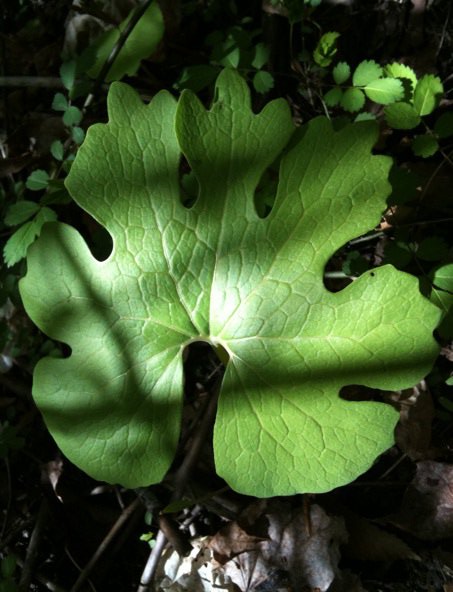
Various Wildflowers and Foliage to be found in the Spring.  April 2010.

Crab Apples November 2010
I could see a footpath on the other side of the creek but could not determine how to get over there.  In the spring, the creek ran fast and deep and in my sneakers I could see no way of crossing there.  An exploration of the surrounding streets showed no signs of a point of access.  This morning I decided to try this path again in the hopes that what footpath existed might be seen more clearly without all the dense green foliage.  No path on the south side could be seen, but I was able to cross the creek here.  A natural path of stones jutted out from the much shallower water and I was able to continue on the north side of the creek. 


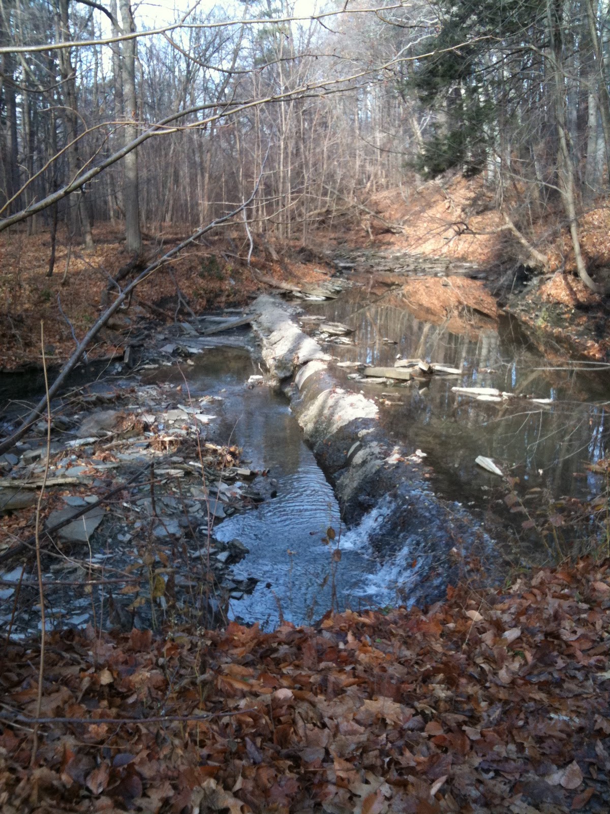
[At this point, I no longer recommend going further.  It is easier and far safer to access the remainder of the creek by backtracking to Westmount or Royal York Road. , and then accessing the official path again from the south of the creek at Chapman Valley Park.  I can no longer locate a listing for this park on the City of Toronto website directory of parks.  You can access this park by following Chapman Road east from Royal York until you reach a sharp bend in the road.  You should be able to access the park from there.]

Looking Down at the Creek from High Above.

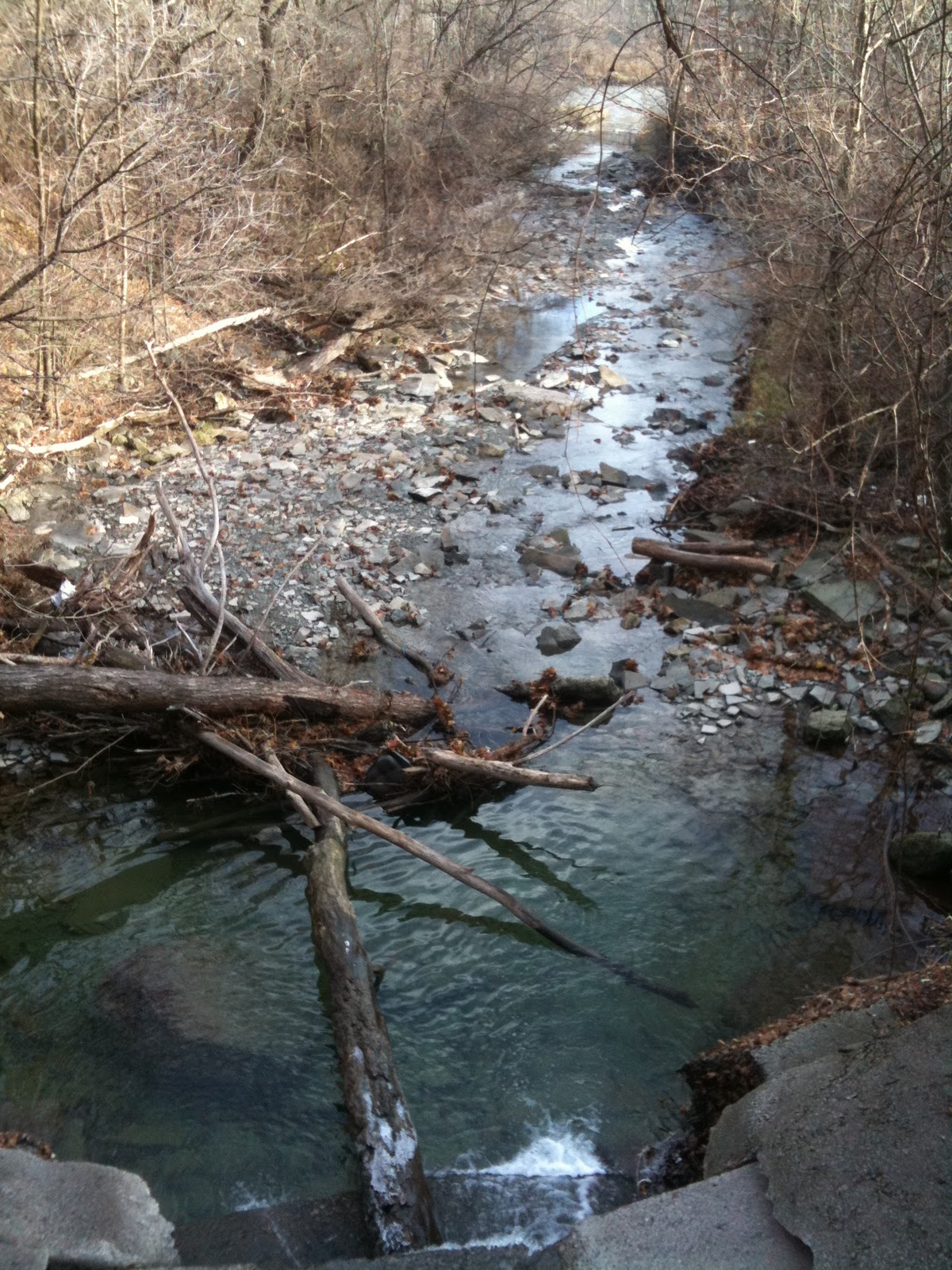
This part is much rougher and less used then the path before I crossed the creek.  Many large trees have fallen across the path and I need to clamour over them.  This area is very rough terrain, and to my left as I walked eastward a sharp hill rises.  Many houses line the ravine high above me.  To my right, the creek drops further and further below me and it is not long until there is a good 15 foot drop on that side.  The path stays far enough from the edge that I feel okay until we get close to its absolute end.  Here the terrain has become so steep it is impossible and treacherous to walk further.  I track my way back and notice a place where others have obviously climbed down to the creek bed and then climbed up the other side.  Both accesses look steep and doable.  The way down was more treacherous than I was expecting, the soil was very soft and crumbly and I fell at the bottom when I was unable to keep my feet from sliding.    At the base of the ravine face, it is much steeper than it appeared from the other side, but I managed to make my way to the top.  At the top, there is a wide natural ledge, with another sharp rise of hill to the right.  I follow along the creek until I meet up with the official path at Chapman Valley Park. This path is very short, maybe another quarter of a mile in total and hits Scarlett Road with a very steep hill to climb to access the road.  Raymore Park runs along Scarlett Road on the east side.  However there is no pedestrian crossing here.  Traffic runs fast so extra caution must be used to cross the road, otherwise you have to go a considerable distance south to use a lighted crosswalk.

I am trying to find out some historical information on the Ravine or Creek, but have had no joy.  It may warrant a trip to the reference library or land registry office to try to determine some of it’s secret history.

Where Chapman Creek meets Humber River at Raymore Park, Etobicoke
I headed north along Raymore Park and Lions Park.  I will do a blog on Raymore Park and Lions Park another time.  Their history is deeply rooted in the events that have shaped the City into what is today and it truly deserves it’s own blog.  I picked up Lawrence Avenue and made my way home.  This walk was a truly challenging one and at the end of the day, my legs felt the burn. 

  • Duration of Walk:  Roughly one and 1/2  hour from my doorstep and back (based on short legs and picture taking )
  • Difficulty: EASY to DANGEROUS.  Chapman Creek is unpaved/ungroomed, but walking on the actual paths at the east and west end are short and no too difficult.  To trek the whole is very challenging requiring climbing, dealing with obstacles and high drops.  Not recommended.  
  • Parking/Getting There:  There is a parking lot at the Metro/shopping complex across the street from Douglas B. Ford Park.
  • Washrooms:  No.    
  • Local Coffee Haunts:  No.  
  •  Safety Factor:  DANGEROUS.  As stated above there are many opportunities to injure yourself here.  If you must venture into the ravine itself, take a buddy and proceed with extreme care.  
  • Special Gear:  Yes.  You will need suitable hiking boots, preferably water proof.  Bring clothes you don't mind getting muddy.  
  • Suitable for Dogwalking?: No.  There are many sensitive plants along the creek which may be damaged or destroyed by dogs.  The path is very narrow, basically just a footpath, and it would be impossible to keep a dog solely on the trail.  

Eaton Centre and Nathan Philip Square (Two short Holiday walks)

I work Saturdays in the financial core.  The Friday freeze and flurries were a reminder that I really needed to get some boots.  I knew the best sales would be on Saturday as the stores here are trying to mimic the Black Friday/Saturday magic that occurs below the border.  I only work half days, so I decided to head out extra early and hit the Eaton Centre before I went to work, since it was so close to my office. 

Thankfully, some of the larger department stores and big box stores were open extra early.  I had a quick breakfast and a certain big box store specializing in outdoor and construction wear for men helped me out considerably in the boot department.  Probably the warmest boots I have had in years and these are supposed to be waterproof, although I haven’t tried them out that aspect yet.  My boots tend to go through a considerable amount of wear and since I have yet to have a pair make it though a year.  I also got a couple of pairs of nice jeans there at a great price.  Never think to look there for my outdoor gear, but I’m definitely going to keep them in mind for the future. 

Given the fact that it was really cold outside I trekked my way to my office through the Eaton Centre.  I will totally disclose here that despite the gender stereotypes, I HATE to shop.  Detest it.  I’m a power shopper.  I research before hand, know what I want to buy, pop in the store, grab it and go.  I will spend the minimum amount of time that I can, the bulk of it usually in line for the cash register.  I love online shopping but when it comes to clothes, given my petite size, I need to try things on, so inevitably it means that I have to hit a store.  Shopping malls are the worst of all.  My husband is a shopping mall addict and spends lots of time in them, but thankfully we work very different hours so we don’t usually have enough mutual free time to hit a mall together.  Mall walking is a popular exercise, especially amongst the older set, so I’ll give it a spin someday and perhaps I will do a blog on mall walking, but that may be a long, long time down the road. 

I made my way from the North end of the Eaton Centre to the PATH at the South end.  On a good day, this place makes me want to flee.  It is claustrophobic, especially at its busiest when the halls are jammed with people.  It has a dark, dungeon like feel on the lower floors.  It is loaded with lots of teen-centric fashion stores blaring unnecessarily loud music.  The high school lunch room/cafeteria-style dining in the South food court forces you to dine communally in elbow bumping intimacy with total strangers, most often with young kids happily oversharing their burgeoning sex lives in loud voiced bravado or peppering their most, like, boring, like, conversations in F-Bombs.  (And I have just realized as I write this that I have become grumpy and middle aged.).  But just in time for Christmas this year, the Eaton Centre is going through massive renovations.  I can’t tell you how long that’s been going on, because that last time I was there was Christmas of last year, but I do have to wonder about the poor planning of it all.  The mall gets very crowded during the Christmas season, and all the scaffolding and barriers jut right out into the walkways.  The Swarovski crystal tree is up, the highlight of the mall’s Christmas decorating.  I have always enjoyed and preferred to view the tree from above, but this year that view is seriously hampered by the construction work.  Nothing gets one in the spirit to shop like construction and I have to wonder just how much business will be lost this year by annoyed consumers taking their business elsewhere.  I couldn’t even bring myself to take a picture of the confusion.

I headed down to the bottom level of the mall and crossed Queen St. underground.  I made my way through the basement level of the flagship Hudson’s Bay store, and they were, I’m happy to report, ready for the Christmas shopping season with Christmas style candies and decorations all set out on the bottom level.  From there I continued south through the new portion of the PATH which takes you under 333 Bay Adelaide.  A lot of Core workers were very happy for this new portion of the PATH which made walking to and from the Eaton Centre from many of the downtown towers more convenient.  No coats, no traffic, no cold, no rain. They have very modern Christmas decorations with lots of Plexiglass triangles grouped together in the shape of trees and lit with very tacky changing neon coloured lights.  Scotia Bank is the next hit on the PATH.  They usually have a large tree in their concourse, but I did not notice it on Saturday.  First Canadian Place is under extensive renovations as well.  I always thought their decorations are very elegant compared to a lot of other places in the downtown Core.  Trees lit with cool blue lights and sparkling silver snowflakes and globes.  But moving through the PATH here is hindered with barricades creating very small corridors for traffic.  I continued on to the TD Centre and off to work for the day.  

My plan for the evening had been to walk around the downtown for a bit after work and capture some of the sights above ground.  But my husband decided he wanted to bring the kids downtown for the lighting of the Christmas Tree at Nathan Philip Square and my plans changed.  They met up with me after work and we set off.  First we visited the huge Christmas tree behind my office building.  Set in blue lights, this tree (which isn’t really a tree but rather a frame covered in boughs) is several stories high and covered in blue lights.  It’s gorgeous at night and is off the beaten path on less travelled Wellington Street (between Bay and York), so it isn’t really seen as much as a lot of the other downtown decorations. 

Wellington Feeling a Little Blue
We then headed North along Bay Street.  At Bay and Adelaide, the new tower (333 Bay Adelaide) has a beautiful projection of stars in their lobby that can easily be seen from the street.  It was a huge hit with my kids.  We hit the flagship Bay Store and walked around it to see if any of the windows had animated displays yet, but found no joy.  We continued up Yonge Street.  The Christmas lights on Yonge make me nostalgic for the 70s.  Blue, yellow and white, they light up the street with a very retro feel. 

70's all the way.
We checked out Yonge and Dundas.  I love this corner, it always has a great energy, day and night.  On any given weekend you will find all sorts of small festivals, concerts, buskers, street artists and entertainers. 

Batman Busking at the Square
As a pedestrian, they have one of my favourite features here, a trial pedestrian scramble in which every few light changes pedestrians are allowed to cross diagonally across the street.  We checked out the tree and some lovely polar bears made of white lights.  (On a fun note, “The Big Kiss” will be held there on Thursday, December 2, 2010 between 6:00 pm and 7:30 pm.  A giant ball of Mistletoe will be hung at the square and couples are invited to stop by and spread a little Christmas Cheer.  For every kiss, Virgin Mobile will donate $5.00 to WWF Canada).

We stopped for a brief dinner in this area before heading west on Dundas and then down south again on Bay.  City Hall is all decked out in red lighting. 


We stayed at Nathan Philip Square for a little over an hour, catching the concert highlighting Sean Desman and Divine Brown and a really fun trampoline display that had both of my kids squealing with delight.  Nathan Philip Square, like everything else downtown it seems, is under renovation and much of the square is currently blocked off by barricades and fencing, making for a very intimate crowded gathering.  The Tree is not in its normal location but rather in the North-east corner of the square and is only half the height of the usual tree due to the renovations, standing at around 30 feet.  They did a lovely job decorating the tree this year.  Its lighting kicks off the 44th annual Cavalcade of Lights (many of the lights around the city are already on, but this is the official start). 

A smaller tree this year for Nathan Philips Square.
We have never made it out to see fireworks at the Square before and I have to say they really put on a spectacular show.  We were right up front and it was amazing to see them framed by the two towers of City Hall. 

Kaboom!

It was a fun evening and I highly recommend to everyone to check out a Christmas tree lighting in the square in the future.

I will take that Christmas light walk I had originally been planning on later in the week and blog a little on the Holiday spirit in the Core.

(all photos in this entry provided by Darryl K.)

  • Duration of Walk:  Roughly one hour (based on short legs, picture taking and walking with children)
  • DifficultyEASY.  Level Terrain, paved surfaces. 
  • Parking/Getting There:  Lots of parking in the office towers with reduced rates on evenings a weekends, however still expensive. Recommend TTC.  St. Andrews, King, Queen and Dundas stations will all put you in the vicinity. 
  • Washrooms:  Yes.  Eaton Centre has public washrooms and as well there are number of restaurants along the way. Be polite and support a business by buying a little something while you're there.
  • Local Coffee Haunts:  Yes.  Tons ranging from Tim Hortons to Starbucks to Timothy’s International and Second Cup.  Diners are also located along Yonge St.  Also a few places to stop and get your beer or wine on too.
  • Safety FactorMEDIUM.  Loads of people, especially at Yonge and Dundas, but has been known as a high crime area; be mindful, especially of pickpockets.  Numerous intersections to cross.  Wellington Street is very dark and there are few people around.
  • Special Gear:  No.  Comfortable Shoes will do.
  • Suitable for Dogwalking?:  Sure but given the crowds of people, might be best to leave your pal at home.  

Monday, November 29, 2010

The PATH to Christmas

I’ll expand on the PATH in a future entry.  In a nutshell, the PATH is an underground corridor in the downtown core/financial district that allows access between most of the major towers, Union Station, the Eaton Centre, Roy Thompson Hall, several subway stations and other amenities, allowing the average pedestrian a way to opt out of the elements and traffic.  It is also to some extent a very large underground shopping mall with many big name stores, restaurants and food courts all servicing the many office minions who work in the area.  It is dark and tunnel like.  As such, there is an attempt to bring some seasonal cheer to brighten it up a bit and get people in the mood to shop. 

I’ll start at 333 Bay Adelaide.  This is a new office building, its first Christmas was last year and the extension of the PATH underneath it, connecting the PATH to the Bay and the Eaton Centre, was very welcome.  You can access the PATH from the lobby of this building by taking the escalators down at the back of the building.  As you walk down the corridor you will see ahead of you clear plastic triangles assembled into the shape of the tree.  There are a number of these “trees” both at ground level and in the food court of Bay Adelaide.  The tree at the end of this corridor is the most ornamental, with all of its panels etched with decorative, swirling branches and and ornaments.  All of these “trees” are lit in sort of a fibre optic style, and the constantly changing colours remind me of those cheap decorations you can get at discount department stores.

This would totally be a Lucy Van Pelt tree.
If you turn right in this corridor you will head into Scotia Plaza.  Looking left you will see a large Christmas tree and snowflakes.  This tree is notable for not being lit in blue lights, like all the other major trees in the financial district.

A more traditional tree at Scotia Plaza
Keep to the right and head west on to First Canadian Place.  FCP is currently undergoing extensive renovations which are making getting around the main portion of the building a little difficult, but you can still appreciate some of the more elegant decorations in the Core.  Small trees with cold blue lights are scattered around both the concourse that the PATH runs through and on the ground level.  Glittering snowflakes, globes and crystals, lit with purple and blue lights, gracefully hang over the waterfalls. 

Everybody uses Blue Lights Downtown.  FCP.

Festive lighting above the Waterfall at FCP.
Head south (the corridor next to the LCBO) and walk through the TD Centre.  Red Ribbons and Silver Balls composed from lights are strung on the ceiling.  It is a little uninspired, but given the darkness and total lack of colour in this portion of the PATH, it does help to liven the place up a bit. 

Some colour for the TD Centre
Following the PATH south, turn left at the TD Branch and go on through Commerce Court.  Keep heading straight, there’s nothing to see here, walking towards BCE Place and Union Station.  The food court at BCE place is quietly decorated with wicker balls adorned with yellow lights.  The real showcase here though is above ground.  Take the staircase at the food court up to ground level.  The beautiful glass hall of the Allen Lambert Galleria is stunning at any time, but during the holidays, it takes beautiful to a whole new level.

Head back down the stairs and continue southwards on to Union Station

Allen Lambert Galleria, dressed up for the holidays.


  • Duration of Walk:  Roughly 1/2 hour (based on short legs)
  • Difficulty: EASY to MILD CHALLENGE.  It is enclosed and out of the elements.  You do not have to deal with traffic.  However in many places you will be faced with stairs, hard to open or heavy doors and narrow, steep escalators, which may prove to be a challenge for those with mobility issues.  
  • Parking/Getting There:  There are numerous parking garages in this area, but they are pricey for a short jaunt through the PATH even with weekend rates.  I recommend TTC.  For my suggested starting point you should get off at Queen and walk south through the Bay until you hit Bay Adelaide.  Other stops on this part of the PATH are King, Union and St. Andrews.
  • Washrooms:  Yes 9 a.m. – 5 p.m. on weekdays only, mostly located in the numerous food courts along the PATH. 
  • Local Coffee Haunts:  Tons, ranging from Tim Hortons, Starbucks, Second Cup and Timothys International, as well as numerous smaller chains and independents.  Pick your poison.  Expect painfully long lines at all Tim Hortons and Starbucks locations.
  • Safety factor:  HIGH.  During the work week, the PATH is crawling with people and security. 
  • Special Gear?:  No. A lot of women walk this in stilettos. So you can get away with pretty much anything here.  
  • Suitable for Dogwalking?: No.  With the exception of service dogs, security is going to be all over you in two seconds flat.  That being said, I have scooted my dog from parking garages to ground level exits in the PATH. 

Friday, November 26, 2010

Blow, blow thou winter wind ...

Blow, blow, thou winter wind
Thou art not so unkind
As man's ingratitude;
Thy tooth is not so keen,
Because thou art not seen,
Although thy breath be rude. -  
William Shakespeare

Today winter got all up in our faces.  Frankly, I don’t know what its problem is.  Seriously.  It always thinks it’s going to impress us by blustering in, howling its arrival brashly.  At least it didn’t feel the need to bring it on, with snow – yet.  Others were not so fortunate.

I’m not a big fan of winter.  It’s pretty and has its moments.  I just can’t do cold and the older I get, the worse it gets.  I guess I have more of a Caribbean soul than a Canadian soul. 

And today was a stark reminder that I need to stop procrastinating and get around to buying a pair of winter boots. 

At least I don’t have to walk in today’s wind.  I work a 12 hour shift today so there will be no time for more than a quick jaunt to the corner to catch the bus.  This is when I thank all that is great and good for the PATH.

So while I’m getting ready for work, I’m burning my Bob Marley cds to my phone, and once I’m on the subway I’m going to close my eyes and dream of warmer days.  

Thursday, November 25, 2010

Toronto Discovery Walks


Not long after we moved to Toronto, I began to notice these strange brown signs all over the place.  Two brown circles.  One with arrows, the other with footprints.  All mysteriously labelled with “Discovery Walks”.  No one that I asked seemed to know what they were for.  After a while they just blended into the surroundings and I stopped noticing them.

This spring my dog was old enough to begin taking extended walks and he seriously needed them.  He was so hyper that the only way it seemed we could get any real peace was to walk him.  I’m not talking about a jaunt around the block; it requires an undertaking of several hours.  I’m certainly not going to complain.  I wanted to start walking again and it seemed like I had found the right match to get myself back on track.  The only problem is that I have a very poor attention span and get bored easily.  I found that doing the same route day after day got old fast.  I turned to Google maps and looked for green areas, but found that to be hit or miss.  Some places might be suitable for walking, others might just be wooded areas without any sort of trail or path at all.  The City of Toronto website listing of parks was equally frustrating, as it didn’t always point out which ones were suitable for extended walks.  Some of the park listings had very little information at all.  I found all sorts of information on hiking outside of the City, but it had certainly looked like the City itself might have had a lot to offer.  Fishing around on the City’s website, I finally discovered Discovery Walks. 

In my honest opinion, this is one of the best things that the City has put together.  Walking around is one of the best ways to learn about the area you live in whether you have lived there your whole life or you are new.  There are 11 Discovery Walks in total.  Each walk focuses on a different area of the City, walking you through historical highlights and natural wonder, all within the City confines.  One walk may take you through calm, wooded ravines, the next through the vibrant downtown core.  Some stroll through popular venues, like High Park, others through quiet neighbourhoods.  You may pass the final home of a favourite author, catch some interesting artwork, sooth your soul under old trees, stop to smell the roses in a lush garden, find the historic grounds of a native village or learn of some of the more monumental or tragic happenings that have helped to shape the City into what it is today.  These walks are a lot of fun to do with children.  Sometimes the historical plaques are hidden and it can be a real game for kids to find them.  My eldest is obsessed with maps and spent the summer being the navigator.  Most children have a genuine curiosity about the world around them and will find it very cool to check out the city’s secret places and history.  My kids called them “adventures”.  Some of my favourite walks are now Discovery Walks. 

The walks range from one to three hours.  Each route is marked along the way with Discovery Walk signs.  One circle signals that you are on a Discovery Walk route.  The second circle will indicate which direction you may take to follow the walk.  If there are two arrows, this means that you have some options as to where you can go.  As well, you will find from time to time, full posted maps of the Discovery Walk.  Don’t count on being able to use those however as many of the City’s taggers have thoughtfully covered them with spray paint.  There are maps/brochures that are available from civic centres or you can download them from the City website.  I highly recommend the brochures as sometimes there is a fair amount of distance between signs or they can be a little hard to find.  I will caution though, based on experience that sometimes the maps and the signs do not seem to jive.  Several of the walks actually link together, so you could, if you are very ambitious, make a day of it.  The brochures will highlight some points of interest.  The maps within them direct you to those noted points of interest and will also point out where you can park, catch the TTC, find washrooms, and locate historical plaques and Discovery Walk information.  These maps will also indicate some basic terrain highlights, such as steep hills, unpaved surfaces, stairs or intersections that may require a little more caution when crossing.  They also often indicate the best point to start, although you can begin a Discovery Walk at any point in the route.  The brochures also provide the distance of each route and a rough estimate of the amount of time the route will take and the amount of calories you will burn while hiking. 

This past summer, I managed to accomplish visiting half of them, although I have still not completed a couple of them.  Two have become regular walks.  From time to time, I’ll post my thoughts and try to flush out some of the history and high points of each walk.  There are actually a number of other places that I can think of which deserve Discovery Walks, although I’m not optimistic that our new mayor will be making the creation of new ones a high priority.  I hope that I’ll be able to inspire you to discover more about your City through walking. 


Happy Trails!

Wednesday, November 24, 2010

Dogwalking in Kingsview Village

This morning was beautiful and sunny and my boy and I couldn’t wait to get moving.  We stopped and picked up his friend.  I had decided to do the half hour walk to his house instead of driving as it would burn a little of my guy’s wild energy.  It was my first attempt at walking them together and, excepting an incident where the two of them decided they should try for cat for breakfast, all went well for me (and the cat too; no animals were harmed in the making of this blog).  It was nice to get the boys together again and they had a grand time.  All my worries about it being too hard to handle them both at the same time went out the window, minimal pulling and silliness, just lots of walking, exploring, and sniffing all the new smells. 


Today we explored a portion of the Kingsview Village neighbourhood in Etobicoke, focusing on the area north of “Little Mogadishu” (Kipling & Dixon).  Past the bustle of this very busy neighbourhood lies a very quiet community of tidy homes, mostly constructed in the 1950’s and 1960’s, although there is evidence of recent homebuilding activity.  The lawns are huge, something rarely seen in the 416.  The atmosphere is strong with quiet pride of home and the hard working attitude of its residents.  There are few routes of access from the main roads, so traffic is minimal and local.  This does make walking the area somewhat constricting.  I chose to walk without a paper map or map app on my phone and stumbled across many dead ends.  Some streets meet the retaining wall of the 401.  Others are fenced off, ending at wooded areas, backyards or high rise complexes.  Several schools and a Seventh Day Adventist Church are tucked away on different stretches of streets.  Sidewalks frequently come to an abrupt end in the middle of a block forcing the user to cross the street to continue.  Typical of the time and attitude that this neighbourhood was built, sidewalks usually only line one side of the street.  This was not a neighbourhood made for walking but rather built for the burgeoning cult of the car.  There were lots of people out for strolls however, mostly retirees.  This is obviously a close knit neighbourhood, one of those ones where everybody knows your name.  Judging from the prolonged stares, it was obvious that I wasn’t from around these parts or else they just weren’t used to dog walkers.  But it was friendly; many who I passed gave a friendly “hello”. 

In the lower portion of this neighbourhood is a small park.  Basically just an alleyway between Kingsview Boulevard and St. Andrews Boulevard, it consists of one brief paved path with a playground and splash pad on one side and tennis courts and something that looked like it may be a petanque court.  


The hour passed quickly and we made our farewells to our little pal and made the stroll back home, tired for the day. 

  • Duration of Walk:  Roughly one hour (based on short legs, picture taking and doggy care)
  • Difficulty:  EASY.  Relatively flat terrain.  You will need to cross some streets.  However traffic is low here.  Sidewalks are paved and in relatively good condition.  
  • Parking:  Street parking all the way. 
  • Washrooms:  No
  • Local Coffee Haunts:  There is a Coffee Time at Kipling and Dixon.  
  • Safety Factor:  Medium.  I would walk this in the daytime.  Fair number of people about.
  • Special Gear?:  No.  A sturdy pair of sneakers is sufficient.
  • Suitable for Dogwalking?:  Yes.  Dogs must be on leash.  Be mindful of possible unleashed dogs.    

Pass the Caffeine


I’m not sure what I was thinking.  My job requires me to work until the wee hours of the morning.  I’m not exactly at my perkiest on the days after.  But just the same, I volunteered to chaperon a school outing for one of my kids.  I don’t get to see a lot of them because of my work.  It had seemed from the description that it would involve some hiking which usually is right up my alley.  But 20+ children on three hours of sleep, that was a bit much.  All in all, given my general dazed and confused condition, I think I survived it well.

Today’s excursion was to the Kortright Centre for Conservation.  This is a local conservation area that I have been dying to check out.  I had been a little reluctant to go as I was under the impression (given my very, very poor skills at judging distance) that it was some distance outside of the City and I hate to drive.  Turns out it’s just a short jaunt from my home, and is fairly close to Canada’s Wonderland, which we hit at least once a year.  I was won over when, as the school bus approached the entrance to the Centre, I spied a huge hawk perched on a branch overhanging the road.  

Perhaps because of the sudden sharp dip in temperature, most of the day was disappointingly spent indoors.  A small excursion in the afternoon stayed close to the main building.  The children spent their time learning about Huron culture and about the foods and materials that could be scavenged within the woods surrounding the Centre.  

Depending on the time of year, the park opens at 9 or 10 am and closes around 4 pm.  There is a paid admission to access the Centre.  $6.50 for adults, kids are free, parking is $4.00.  There are 300+ acres of woodland with plenty of trails to explore.  I was happy to learn that there is a Maple festival in the Spring.  I probably won’t brave it in the winter, but can guarantee that once the thaw hits, I’ll be back. 

My Secret Affair ... In Pine Point Park


On Monday I started an affair.  The awkward greet of an acquaintance in his home.  Fumbling with strange clothes and collars.  He sensed my inexperience and showed me what to do.  The nervous tension as we built trust in each other.  The elation and joy of a new experience and of the connection, understanding and respect we began to develop for each other.

No, my husband has nothing to worry about.  It’s my dog that needs to hire the P.I.  

I have a friend whose hours at work have changed and now she’ll be away from her house for most of the day.  Her dog won’t make a whole day without being let out at least once during the day.  We’ve made arrangements for me to stop by once a day for a brief walk.   

I did feel kind of guilty not bringing my dog along.  These two are actually walk buddies.  They know each other well and get along famously.  But my dog is still in the puppy phase, and while he’s generally well behaved and follows commands well, when there is another dog around its nutzoid time.  He loses all focus and sees, hears, smells and thinks of nothing else except that other dog.  He pulls, he does violent ballet leaps in the air, he sprints helter skelter to the very end of his leash, he jumps on his friend and on my friend.  Usually it takes a good long walk by ourselves or a run in the dog park to burn a little energy before we can consider a shared walk, and even then it can be a bit nightmarish for the first few minutes of happy greeting.  Once he’s settled it’s not so bad.  I know that I have to keep working on the socialization skills with my dog and also know that his friend will pass on some good leash manners, but the thought of handling the two of them together makes me nervous.  At any rate, I figured it would probably be best for me to at least walk this other dog a few times alone so I could get a good feel of how he walks.  He was a dream dog to walk, so I think we’ll be okay together.   

(The new guy in my life.  November 22, 2010.)

I took him down to Pine Point Park in Etobicoke (Rexdale).  This is a regular haunt, primarily because it can either be done as a short walk on it’s own or as a long extended walk if you continue north into Summerlea Park.  It is a peaceful park that follows the Humber River.  I usually park at the Hadrian Drive entrance and on this particular occasion I decided to head south, which I haven’t done before.  Pine Point Park is located right at the entrance/exit ramps for the 401 on Islington Avenue, on the north side of the 401.  While you generally will be quickly free of the noise and bustle of the highway by heading North, travelling South takes you right into it, forcing you under a gritty, graffiti-tagged underpass.  The noise of the traffic above is amplified and somewhat distressing.  The drone of cars speeding along, trucks changing gears, loud banging and clangs.  It is dark and damp and smells, and covered in all sorts of unpolite, rude and crude graffiti.  This is not a place to get your inner peace on.  

 (Not the most inviting sight.  November 22, 2010)

Immediately after the overpass, you are forced to make a choice.  You can go right, but that path is just a dirt path that will just take you right out to Islington (often, while walking along Islington I had seen people exiting this path and had wondered where they were coming from).  Left takes you over a high bridge and across the river.  


The path continues on for a short while and then connects with Crawford-Jones Memorial Park.  This park is named after Jim Crawford, an area policeman, and Herb Jones, a local contractor who both heroically worked together to save many lives during Hurricane Hazel.  Mr. Crawford received a medal of merit for his actions.  He also witnessed the last execution at the Don Valley Jail, and in fact, the last executions conducted in Canada.  


The park is not fitting of its namesakes.  While clean, it is small, with a solitary picnic table.  We see not one other soul in our time there.  What once had been an open field has now been planted with many trees in the recent spate of city-wide forestry efforts.  In a grove of older trees, someone feeling keen civic spirit has felt it obligatory to hang bags of doggy poo from branches; the blue and clear bagged fecal ornaments bob heavily in the wind.  The path dead ends at Cardell Avenue.

My new guy and I backtrack back to familiar territory, Pine Point Park.  This park is a multi-use community park.  A soccer field is on site; a pool, hockey arena and tennis court are nearby.  There is ample parking at the park and despite its popularity, it is never full.  It features a short heavily used, paved trail (Bicycle Route 15).  In the summertime, the entrance can be litter strewn, but in the spring and fall, it is relatively clean.  Following the trail north, you are flanked on the left by a steep wooded hill.  To the right, the Humber is bottle green and meanders past a small island, tracing broad, graceful curves. 


At this time of year, the trees are bare, leaves heavily carpet the ground below. A stately heron stands guard on the banks of the river.  As you walk, the city din lessens, and is only disturbed by planes on approach to the airport.  We cross the Humber by footbridge just south of Albion Road.  Here we could continue northward to Summerlea, or take the pedestrian connection towards Weston Road, but alas, our time is almost up and we turn around and head back to Hadrian drive. 
 
{A small path not noticed before to explore another day.)

Useful Information:

  • Duration of Walk:  Roughly one hour (based on short legs, picture taking and doggy care)
  • Difficulty: EASY.  Relatively flat terrain throughout.
  • Parking:  For Pine Point Park, generous parking is available off Hadrian Drive.  For Crawford-Jones Park, parking is available off Dee Ave. [? – I didn’t personally check out the street, I’m getting this off of the City Trail map].  You can access Pine Point Park by TTC by taking Islington Route 37North and getting off at Allenby St. and walking east several blocks until it dead ends in the park. 
  • Washrooms:  No.  I will note that there was a Port-a-Potty this past summer located by the parking for Pine Point Park, however I cannot vouch whether it was available for public use. 
  • Local Coffee Haunts:  No.  But I suppose you could hit the McDonalds located a few blocks away inside the Walmart on Islington.  
  • Safety Factor:  Crawford-Jones Park:  Very Low, at least the walk from Pine Point.  Walk at your own risk, have a buddy.  Pine-Point Park:  Medium-High.  Walk at lunch time when the teachers from a local school crowd this park for their break.  Buddies are best.  
  • Special Gear?:  No.  A good pair sneakers is all you need.
  • Suitable for Dog Walking?:  Yes.  Dogs must be on leash here.

Happy Trails!

Monday, November 22, 2010

Back On My Feet

As I’ve noted in my preamble above, I was born with a walker’s soul.  Having been born into a family that walked everywhere, the idea of putting on shoes and “hoofing it” was second nature.  I grew up in a one car family.  My father needed that vehicle to commute.  When you live in small communities and rural areas, there is no transit system and often you have to travel a good distance to bring home a steady paycheque.  When we lived close to town, if we needed to be somewhere, we walked.  When we lived in the “boonies”, it was often a major form of amusement in a pre-cable, pre-internet, pre-video game world.  There was a certain magic and wonder to be found on our endless strolls.  Turtles ambling up pathways, heaps of jellyfish stranded on the beach, the noise and sight of hundreds of frogs during mating season, spiders grown impossibly large in our Canadian climate, close encounters with deer startled out of hiding spots.  I learned about the ocean, the woods, the towns that I grew up in.  A social life in a small town high school invariably meant long walks to escape the prying eyes of our parents.  A university career in a small town with a just a couple of pubs, a small theatre and a coffee shop meant lots of long walks to pass the free time. 

When I first moved out on my own I lived in Halifax, Nova Scotia.  I continued my walking habit on a limited basis.  My longer rambles were confined to the weekend, with short jaunts to the park or stores in the evening after work.  Most things that I needed were within walking distance.  I didn’t own a car so I took transit to work or when I needed to go into the downtown core or other side of town.  A long transit strike one summer back in 1998 forced me into my sneakers and taught me that hour and half walk either way could be pleasant and enjoyable and the best way to get to the office and back; through pleasant neighbourhoods and parks and across the harbour high up on the bridge.  The one neighbourhood that always seemed a little questionable when seen from the bus turned out to be vibrant and lively and friendly.  As it turns out that hour and a half was a reasonable time to commute.  My current Toronto commute by bus and subway currently runs an hour and a half.  When they finally got the buses rolling again, they had lost a passenger, at least when the weather was good. 

Eventually I married and my husband’s work took us to Chicago.  While the city itself was good for strolling (usually with necks crooked back, nose to the sky to gawk at that amazing architecture), and there were the state parks and zoos and gardens, the suburbs where we resided were a wasteland.  We needed a car for my husband’s long commute, but that left me stranded.  There wasn’t anything close to where I lived.  Transit service was very poor and often involved going for long stretches in the wrong direction to transfer to a bus to get me where I needed to go.  Sidewalks were rare and the ones that existed were never cleared in the winter.  My husband is a serious car addict and while he was game for driving to parks for hikes or engaging in some urban exploring when we first married, once we had children his interest and energy waned.  When you’re part of a couple, you tend to do things as a couple, and I walked less and less.  Several problematic pregnancies left me bedridden.  I put on the pounds and lost the motivation. 

When it came time to move back to Canada, one of the reasons we chose Toronto was a vague recollection from some time I had spent here almost a decade before of a decent transit system (at least better than what we had been dealing with) and places to roam.  And for a while, we did roam.  Living near the lake and parks got us out.  But it didn’t develop into a habit, and once I was working again, the thought of it was out of my mind.  I would sometimes think that I should get out the car and check out all the interesting things I was spying, but there never seemed to be time. 

But there has come a realization that I have to make time for myself.  Between demanding work, small children, trying to maintain a home and all the other little commitments we seem to bury ourselves in the person who I was and the things that brought me joy somehow managed to get lost.  I haven’t been a whole person in a very long time.  When I looked back at all the things that had made my happy and that gave me joy, I wasn’t really doing any of them anymore.  It had once been a bit of a running joke amongst those who knew me that if you were going to visit with me, you needed to be prepared to do a lot of walking.  I’ve been slowly piecing together all of those things that made me a good and happy person and getting on track to bringing those things back into my life. 

My first step was to get a dog.  Dogs need to walk.  I’d have no excuse.    I deliberately focused on breeds that were more active.  Last year, when he was a puppy, we were confined to walking around the block or quick jaunts while waiting for children to finish piano/soccer/dance or other activities and that was a good start.  Now that he’s full grown, we’ve been putting on the miles.  We’re walking several hours a day.  I’ve have gotten to know every nook and cranny in the immediate area around my home.  I have explored parks and trails within a stone’s throw of the backyards of friends who have lived here all their lives and had no clue of their existence.  Secret paths are everywhere.  I’ve reintroduced myself to birds, marvelled at urban deer startled by passing cyclists, treasured the soul-restoring silence of a wooded ravine in the middle of a bustling city.  We’ve worn through three pairs of sneakers and two leashes, my dog and I. 

And I’ve kept it up.  I’ve learned to walk part of the way home or to work instead, picking up the subway a few stops down the line, keeping my eyes open to all the sights and sounds.  I’ve discovered whole neighbourhoods with a small town feel deep in the city core.  I’ve learned so much of the forgotten history of this City that I’m starting to grow a little warmer to it.  I tend to get bored very quickly, so I try not to walk the same routes too often.  I’ve been slowly trekking my way across the city from west to east, and at the suggestion of a number of my friends and my own frustration at finding any really useful information about many of the area parks, I will share my thoughts and photos with you.  And I’ll recollect about some of my favourite walks I’ve taken in the past.  It’s going to be a long, leisurely stroll, and I hope you’ll take it with me.