Make Time to Walk

Everywhere is walking distance if you have the time. ~Steven Wright

I was born a walker. Growing up in a one car family that my father needed to get to work while living in the outskirts of town meant that if you wanted to do anything or go anywhere you relied on your feet. This was so ingrained that I did not bother get a drivers license until I was 25. When I moved to the city in my early adulthood, I relied on buses to transport me to work until a strike taught me that the hour and a half walk to and from was reasonable and pleasant, at least on the good weather days. For seven years, while living in the car-obsessed and sidewalk-phobic suburban USA, I slowly lost the habit, but I've been gaining it back, going on almost daily adventures of urban exploration.

It never ceases to amaze me how little many of my friends know of their own backyards, even when they have lived in the area all their lives. We have traded an adventurers' soul for the mundane, stress inducing car commute, even driving to the store a few blocks away. Reassessing my own life and stress, I came to the realization that I was a lot happier as a walker, in the fresh air, in nature, interacting with people, seeing the small little things that make city life or country living so pleasurable, and which often get missed in the car.

I'll share my favourite walks and memories in and around my current home of Toronto, as well as Halifax, Chicago and Paris. Take a stroll with me.

Tuesday, March 29, 2011

Strolling along the Humber


Humber
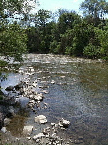
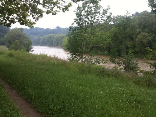
The Humber, as seen between Cruikshank and Lions Park, near the intersection
of Lawrence Ave. W and Weston Road, Etobicoke

[This is an intro to a series of walks that I will be posting in relation to the Humber River.  While I have have walked the whole of the river from the City boundaries to the Lake, I have yet to attempt an full, unbroken trek from the top of the city to the bottom, but have plans to do so in 2011. ]

Toronto has the unique distinction of having Canada’s only designated urban Canadian Heritage River flowing through it’s bounds, the Humber River.  This beautiful river gently dissects the city from top to bottom with a graceful, peaceful ribbon of green.  The river is one of two that divides the city, creating natural geographical boundaries that physically separate the city into distinct regions.  The other is The Don River Valley on the East side of the City.  I have yet to make my way to the Don yet, but I’m slowly moving eastward in my treks and hopefully I can start some trekking there this summer.


photo.JPG
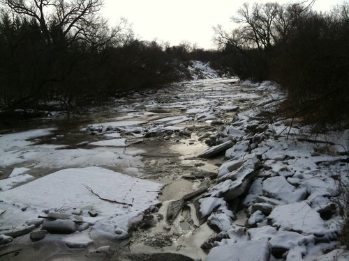
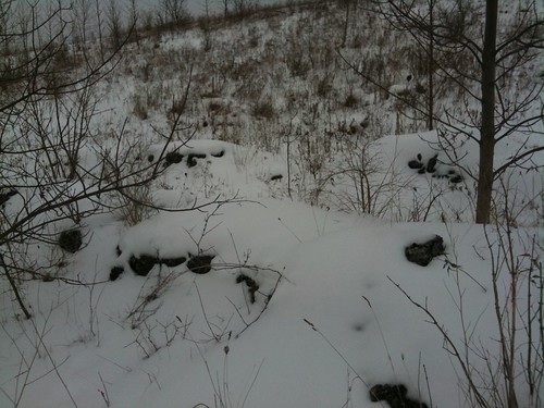
Temporarily Tamed by Winter's Touch
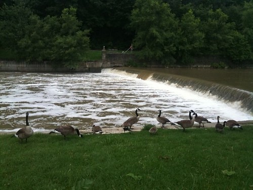
What makes the Humber so culturally important and why should you care?  First and foremost it is beautiful.  It wends and twists and gently curves it’s way to Lake Ontario.  Old trees grace it’s shores.  A multitude of birds and animals, including deer, can be spied near it’s banks, bringing the wilderness straight the city.  It has carved deep ravines through the city creating an oasis of peace and silence.  You can be conscious that the city’s hustle and bustle might lay just beyond the crest of that hill but be so far removed from it that all cares and worries are forgotten.  At first glance, it seems slow and calm, but watch the water flow over many of the engineered spillways along its route and witness its mighty power.  At its end, it swells and slows and supports a serene marsh.

photo.JPG
 Summerlea Park, Winter 2011
It was first used as a trading and portage route for our First Nations peoples and the “Toronto Carrying Place Trail” follows it’s banks.  Earliest evidence of human settlement along this river points back in time to a possible 10,000 years of human impact on the river.  

photo.JPG
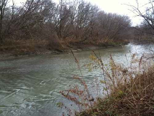
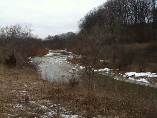
Late Fall 2010, Pine Point Park
There is debate as to whether Étienne Brûlé, on behalf of Samuel de Champlain, became the first European to explore and live along the banks of the river, establishing trade and diplomatic relations with the First Peoples here.  One park along the banks of the river is named after him, however many scholars now believe he may have actually located much further west.   

photo.JPG
Summer 2010, Magwood Park, Etobicoke
The Humber was vital to the early development of the city.  Fort Toronto was founded at it’s foot where it met Lake Ontario and was a temporary home of the first Lieutenant Governor Simcoe when he first arrived in the area.  Settlement continued to grow outwards from the Fort.  Over time the fast flowing waters powered numerous lumber and grist mills along its banks, providing the materials to build the city and strengthen its economy.  

photo.JPG

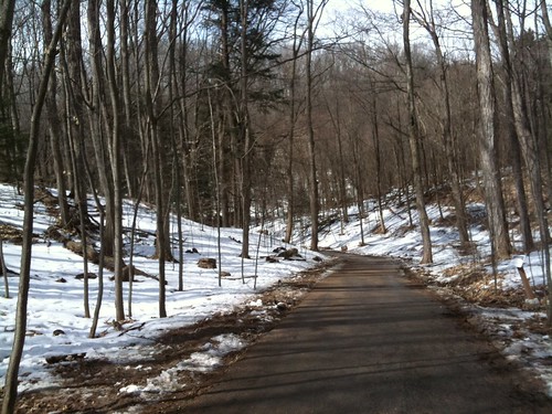
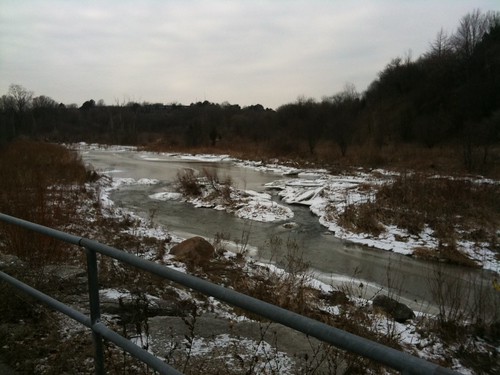
Kipling Heights Park [not 100% sure on that one - may have been further up river],
Winter 2011, Etobicoke
On the night of October 15, 1954, Hurricane Hazel struck the City with great force.  It is rare for a Hurricane to make its way this far in land, usually they dissipate in strength once they hit landfall, and indeed, while this storm had been downgraded to a tropical storm, it proved to be a powerful one.  Already, it had caused horrendous devastation in Haiti.  It tore through the Carolinas and, instead of losing power, then steamrolled its way northwest to Toronto.  Despite, what was for the time, very accurate weather forecasts, few people paid heed to the warnings.  Storms of this strength had never been experienced here and the naïveté of Torontonians created a lax atmosphere that was unprepared for what was to come.  The storm raged late into the evening.   The water table was already saturated from heavy rains experienced the week prior.  Streams, rivers and creeks were at their peak.  The stage was set for a disaster.  

Raymore

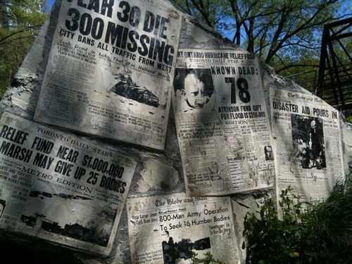
Memorial to Victims of Hurricane Hazel, Raymore Park, Etobicoke.  This memorial
incorporates 

the remains of a bridge swept away by flood waters. 
The rains of the evening proved too much and large flash floods raged through the City along the Humber River, Don River and Etobicoke Creek, taking residents by surprise.  Many houses were ripped from their foundations, bobbing their way along the rushing waters towards the lake; some residents spending a cold terrifying night on their roofs, waiting for rescue that could not come.  Efforts to aid victims were hampered by the strength of the currents and an inability to find boats of sufficient horsepower to navigate the waters.  Many of the rescuers quickly became stranded themselves or lost their lives to the raging currents.  Thousands were instantly rendered homeless.  Eight-one lives were lost that evening.  Bridges were washed out throughout the city, creating traffic snarls for months after.  Several highways and rail lines were washed away, including the 401, creating headaches to find alternate means to move goods across the country.  To this day, with an estimated cost of at least $1 billion of today’s currency, it remains the largest natural disaster ever recorded in Canada.

Humber Firemen
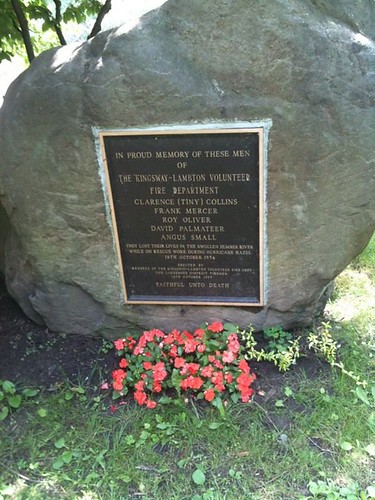
Memorial to firefighters lost in the chaos of October 15, 1954.
Their firetruck was swept away as they attempted a rescue.
Home Smith Park, Etobicoke
The Canadian military was called in to deal with relief efforts and clean up.  Relief agencies immediately went into action, raising millions of dollars of funds from all over the world.  Provincial and federal governments expropriated much of the property along these rivers and placed strong restrictions on further development.  National flood plain management and strategies were implemented nationwide to prevent similar disasters elsewhere.  The Toronto and Region Conservation Authority was created to help manage these areas.  These areas are now planned as flood zones, where water can be allowed to move freely through the City without major impact on nearby residents.  Spillways, dams, retention walls and other engineered features along the river help to restrain and minimize flooding and direct the water when needed.  Yet even with all that management, the River is one to be respected.  Flash floods still do occur especially during the Spring thaws or after heavy rains.  Its current is strong.  Along it’s banks lie memorials to victims, many children who have been caught within its grip.  

photo.JPG

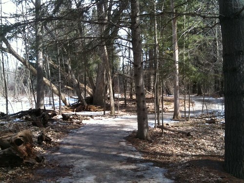
I shamefully wish I could tell you exactly where this picture was taken, but 

I seriously need to work on my note-taking skills...  Winter, 2011
But out of that horrible devastation, Torontonians were given a special and unique gift.  Deep into the heart of the City, fingers of forestry and nature tangle their way seductively towards the Lake.  Deep forested ravines isolate portions of the rivers from the City creating sanctuaries of greenery and silence.  Long stretches of recreational zones have been created along its banks and are easily accessible to most within the City and provide opportunities for biking, hiking, jogging, rollerblading dog walking, boating and fishing.  Need a first date idea but not a lot of cash?  A stroll along the Humber’s many parks provides an idillic spot to picnic and walk hand in hand.  Bird enthusiast?  The Humber provides plenty of opportunity to spy your avian friends.  Avid cyclist looking for an opportunity to bike a long distance without City traffic?  The numerous bicycle paths along its banks negotiate steep hills and turns and it’s long distance is a good opportunity to work on your endurance.  Don’t have a car but want to experience nature?  This is close enough and is easily accessible all along it’s bank via the TTC.  A portion of the trail system is even accessible by subway via Old Mill station.  

Humber Geese
Magwood Park, Summer 2010
In the following weeks, I will continue on with more in depth segments of the parks to be found along it’s path, in chunks that will allow for 2-3 hour hikes.  Several Discovery Walks also line it’s shores and I will focus on them as well.  Hopefully, I can aspire you to get out and take a hike, and if you’ve never been here before, experience a portion of the City that is like no other.  

Humber Mural
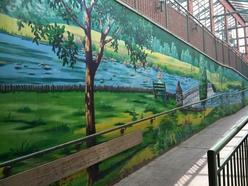
A mural tribute to the Humber found at Loblaws near Dundas St. W. and Scarlett St.,
Etobicoke
Happy Trails!

Some links of interest:

Wednesday, March 23, 2011

The Breakup

photo.JPG

Dear Winter,

I really don't know any kinder, gentler way to break it to you so let me be blunt.  It's over.  I just can't see it working out anymore.  You have your thing and I have mine.  I have tried to live with who you are and what you do.  I have tried to love you just the way you are.  But I just can't do it anymore. Do you have to be so dark and gloomy?  Is it reasonable to delight in the one you love being curled in a corner, all SADD and blue?   In any relationship, there has to be a little bend, a little flexibility.  I have given myself over to you, thrown myself into your arms, dealt with your cold shoulders.  But like the good ship Enterprise, NC-1701, "I just canna take it anymore, Captain!".  You were all so seductive, soft and tempting at first and then once you had me, wham, you let it loose.  You have beaten me down with snow dumps and bitter cold, threatened me with massive icicles.  All the blankets, warm wooley socks and chocolate chili chai in the world have not sheltered me from your cold, bitter, icy heart. 

I made it clear we'd be "special friends" this year but I also made it clear that there would be an expiry date for our "friendship".  Spring has always meant more to my heart and I know she's coming, so you need to clear out before she moves in.  In case you didn't hear, the Spring Equinox was just a couple of days ago. And Wiarton Willie and Shubenacadie Sam both promised on your behalf that you'd be gone by now.  

I know what's going on, don't deny it.  Your little tantrum doesn't impress me much and it certainly isn't going to change the way I feel.  You have to accept the fact that we're through.  So go ahead, get it all out.  I'm patient, I can wait, but only for so long.  I'm sorry it had to be this way.  But I hope you know we'll always have January.  


Monday, March 21, 2011

Revelations


photo.JPG

It’s always interesting in the late Winter and early Spring when the first snow melts are witnessed.  So much of our sins are hidden away by the snow and are revealed on masse with the first melts.  Many cultures revere this time as one of rebirth, but I look at it as a time of revelation.  Confessed in harsh brutal truth are the empty chip bags, lost receipts, cigarette cartons, paper mugs in Christmas designs, old notes, fast-food chain toys, mounds and mounds of dog pooh that had been kicked under the snow, old used condoms and discarded clothes.  It says a lot about who we are and our vices.  They can only be hidden for so long.  Sooner or later everything that is wrong about ourselves becomes revealed, often uncontrollably and we are forced to deal with it and clean up the mess.

photo.JPG

I have had my own spring thaw during the last few months.  The revelation of a lot of personal things that I had been in denial about but which I could no longer ignore.  I have been in the throes of some soul crushing heartbreak and self-pity which I dealt with by burying myself in my work, my children, bad TV and even worse books.   Running and running on my treadmill.  I should have been walking.  It’s not to say that I wasn’t entirely on my feet.  Of course I kept up the dog walking.  There was one night spent wandering my neighbourhood in my pyjamas in the wee hours of the morning.  But there has been very little enjoyment in my walks the past few months and a whole lot of stumbling about, a little lost, dazed and confused.  But it’s Spring and time to set things right, clean up my own little mess and walk on.  


photo.JPG

Wednesday, March 16, 2011

Maple and Mud


Sugarbush Maple Syrup Festival at Kortright
Different Grades of Maple Syrup
It’s March Break time and if you’re like me you have small children to amuse and you probably need to do it cheaply.  Last summer, I dragged my children over half of Toronto exploring many of the parks and ravines the City has to offer.  All for free or for a small fee.  I hate spending money.  And I want my children to have an appreciation for the world they physically live in, not the one they see on the small screen.  But just how many petting zoos and magic shows can you really do in a lifetime?  The Kortright Centre for Conservation is a great place to go.  It has a very low admission price and they have tons of programs all year long that are both educational and entertaining for children.

My husband decided to take the week off to spend with our kids.  He spends a lot of time working overseas and rarely has the opportunity to spend quality time with them.  I had noticed the last time that I had gone to the Kortright Centre with my son’s school field trip that they had a maple festival.  Perfect for my husband and his maple obsession and a great learning opportunity for the kids.  I could taste the family outing potential!  I mentioned to my husband last week that I suspected that it must be happening soon, if it hadn’t already happened.  He checked the site and sure enough, just in time for March Break, the festival was in full swing with a ton of activities for the kids.  I had been hankering for the winter to be over so that I could check out some of the trails with the dogs. And the weather was beautiful.  Everything was in perfect alignment for a lovely family excursion into nature.  We piled ourselves, the kids’ best friend and two dogs into the Momobile and headed north. 


Kortright Centre for Conservation

Of course, it seemed like half of Toronto felt that way too.  We left several hours later than we were planning.  It was almost lunchtime before we hit the road.  We got there in great time, but the cars were piled up at the entrance.  After over half an hour idling, the dogs were getting antsy and I got out to walk them around while my husband continued to the entrance.  By this point in time he was told that the park was “closed” because all of the parking spaces were gone, but they still let him in and he was able to find a spot.  

Kortright Centre for Conservation

We made our way to the visitor’s centre and picked a map and brochure.  Just outside the visitor centre, a huge line up awaited to board the wagon rides which were set up to take enthusiasts through a small loop near the entrance of the park.  We decided to forego that and went right for the maple tour.  

Kortright Centre for Conservation

There are two types of tours you can take, a self-guided tour or a directed one.  We had a handy map so we decided to hike ourselves.  It seemed like a pretty easy loop and we had a couple of dogs with us and kids with low attention spans so we decided to head on ourselves.  It was the perfect day for a family outing.  It was a wonderful, balmy 11 degrees outside and really comfortable.  A word to the wise however.  Despite all the snow still on the ground, the spring thaw is underway and it’s pretty muddy and still very icy in places.  Wear waterproof boots with good grips.

Muddy Boots
Mud was the secondary theme of the day.  Our boots were coated.
And don't get me started on the state of our dog's fur...


Kortright Centre for Conservation

The path starts right behind the visitor centre.  There are tons of people hitting the festival so it’s pretty easy to just follow the crowds.  All along the walk, signs highlight interesting facts about maples and maple syrup and its production.  At the bottom of the first steep hill is a small display demonstrating how First Nation Peoples gathered maple sap, cutting a gash in a tree and using twigs to guide the sap into hollowed out log/troughs.  

Sugarbush Maple Syrup Festival at Kortright
Displaying First Nations methods to collect sap.
A short distance further and you spy trees with metal buckets attached.  You are free to go ahead and have a look inside.  My children were surprised by the contents.  “There’s water inside!”  No, that’s tree sap.  It was hard to make them understand that this would become maple syrup.

Sugarbush Maple Syrup Festival at Kortright
That's not water ... that's future pancake dressing.
We walk further on and round a bend to come across some demonstrations of early maple syrup production.  Rough, crude buildings house shelter steaming kettles.  Firewood, at the ready to keep the fires roaring, are stacked to one side.  A small group of people, dressed in early settler type clothes, are hard at work making small batches of maple syrup.  Here you get the opportunity to taste both samples of sap and finished syrup.  The sap lives up to it’s appearance.  It is very watery and almost tasteless.  The syrup is fresh and fantastic and reminds me of the syrup of my youth.  The children stood for a long time watching the syrup boiling away in the kettles.  They seemed genuinely appreciative of the work involved in making one of their favorite breakfast staples.  

Sugarbush Maple Syrup Festival at Kortright
Maple syrup in production.
The path twists onwards and we find another shack, this one demonstrating more modern production of maple syrup.  Outside, lines of plastic tubing hang like garland from the trees, collecting precious sap and drawing it towards the shack.  Inside a demonstration on production and maple grades is being conducted and my husband and the girls decide to hang around to hear the talk.  My son and I continue onwards.  

Kortright Centre for Conservation

I let my son have the map and have some fun orienteering.  We rambled about for the better part of an hour while he tried to figure out where the entrance was for the path that he wanted to take.  We eventually gave up and I pointed him back to the Visitors Centre, intending to pick up the forest trail with him, but we ran into my husband and the girls there.  Everyone was a little tired and hungry and we figured it was time to go home.  But of course, we had to hit the little shop first and stock up on maple supplies!  Maple coated almonds, Maple suckers, Maple butter.  Maple, Maple, Maple.  You can never have too much Maple!

Sugarbush Maple Syrup Festival at Kortright


  • Duration of Walk:  The Kortright Centre pamphlet gives about 1 hour for the guided walk and this was about right.  It took us almost two, but we were rambling slowly and taking our time at the different demonstrations.  We also did a little bit of our own walking after the Maple Sugar Walk.  
  • DifficultyModerately Challenging.  There are very steep hills that need to be negotiated.  Ice and mud make for slick walking surfaces.
  • Parking:  There is parking available, however plan to get there early as this is popular and the lots fill up fast.  There is an admission fee to get into the park, which can be obtained from their website linked above. 
  • Washrooms:  There are washrooms in the Visitor Centre with lots of stalls.  I overheard someone mention port-a-potties, but did not see any.  (March 22, 2011:  To demonstrate how observant I am, if I had looked a little more closely at the pictures above, I would have clearly seen port-a-potties!)
  • Local Coffee Haunts:  There is a cafe in the Visitor Centre.
  • Safety Factor:  Good.  There are tons of people about.  Be careful and mindful of icy patches.  Keep a close eye on small children to ensure no one goes wandering off.  
  • Special Gear?:  A good pair of boots, waterproof, with grip.
  • Suitable for Dogwalking?:  Yes.  There were plenty of dogs enjoying the trail.  Since there are so many people, be polite and leave any overly excitable dogs at home.  Dogs must be on leash at all times in the Conservation Area.