Make Time to Walk

Everywhere is walking distance if you have the time. ~Steven Wright

I was born a walker. Growing up in a one car family that my father needed to get to work while living in the outskirts of town meant that if you wanted to do anything or go anywhere you relied on your feet. This was so ingrained that I did not bother get a drivers license until I was 25. When I moved to the city in my early adulthood, I relied on buses to transport me to work until a strike taught me that the hour and a half walk to and from was reasonable and pleasant, at least on the good weather days. For seven years, while living in the car-obsessed and sidewalk-phobic suburban USA, I slowly lost the habit, but I've been gaining it back, going on almost daily adventures of urban exploration.

It never ceases to amaze me how little many of my friends know of their own backyards, even when they have lived in the area all their lives. We have traded an adventurers' soul for the mundane, stress inducing car commute, even driving to the store a few blocks away. Reassessing my own life and stress, I came to the realization that I was a lot happier as a walker, in the fresh air, in nature, interacting with people, seeing the small little things that make city life or country living so pleasurable, and which often get missed in the car.

I'll share my favourite walks and memories in and around my current home of Toronto, as well as Halifax, Chicago and Paris. Take a stroll with me.

Thursday, July 5, 2012

A Time for Humber.


Ser-Pulls-A-Lot.JPG
"Did you say 'Epic Walk'?"
Who does not long for freedom?  As children, despite the varying magnitudes of restrictions that are placed upon us by our parents, we are at our most free.  We are free within our bodies.  Uninhibited in our souls.  Our thoughts and imaginations soar without boundaries.  Who we are to become is full of such limitless possibilities. 

For children of the modern age, where childhood has been deemed as most precious and the domain of play and dreams, the greatest freedom of childhood is Time.  It stretches before them vast and infinite, progressing slowly.  There is all the Time in the world in which to dream and explore.  The particular golden blessing of the modern child is the summer vacation.  Sure, it may be filled with camps, play dates, soccer games and museum outings.  However, even the most rigidly scheduled child will experience a slowing down, a greater freedom.  There is always that sense that there are a million things that can be accomplished before heading back to school and a million years in which to accomplish them all. 

As adults, pressured under the constraints of work and family, of obligations and bills, Time, and the freedom it allows, is much more precious.  When you are a mom who works full-time, also holds down a part-time job, writes and, for the most part, parents alone, Time and freedom are more rarer and treasured than diamonds and platinum.  Time is no longer a freedom but nagging task-master and who we were becomes lost to it’s constant demands. 

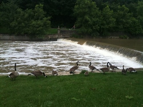
One of the things I have wanted to do for the last few years was to walk the entire Humber Trail from the top of the City down to the Lake.  I have done the whole thing in short two or three hour looped or backtracked segments but never the whole thing at once.  It has always seemed something that would have to be put off.  As a working mom with little support, my days lie rigidly tied to the confines of the school day and my own odd work hours.  My evenings are busy ferrying my children from one activity to another.  I also walk dogs during the day.  While my own dog is a trooper, my other pals don’t have the kind of endurance to go past a couple of hours.  It’s difficult to schedule in that kind of epic adventure with the life that I lead.

A month ago the stars lined up beautifully.  My husband had been sent home from his work assignment in Saskatchewan nursing a broken arm and would be around to meet our children after school.  None of the other dogs I walk needed to be walked that day.  It was cool but sunny, so it likely wouldn’t be too hot for my pup.  It was probably my one and only chance this year to give it a go and I grabbed it, even though I had pressing things to do with work and my home.  Wanting to try some serious hiking this year, it would be the perfect opportunity to see just how big a hike my dog would be happy to endure and to also gauge how much food and water to pack for him as I’ve never taken a long hike with him before.  If I ran into any problems, I live a very short drive from most access points to the trail, so it would be easy to call my husband to pick us up if we needed.  A good trial run. 

I ended up starting much later than I should have because we did need to wait and see what arrangements my husband could make for some last minute doctors appointments.  If I had to be home to meet the kids, the dream would be shelved for another day.  I would have preferred to have gotten the show on the road by 8:30 am but he wasn’t able to make confirmations until midmorning.
  
I packed up, in my better backpack, over a gallon of water, food for both him and me, sunscreen and hat, sunglasses and rain poncho.  I loaded up a fanny pack with the dog’s travel water bowl, a water bottle for me and a few small necessities.  I decided a pair of yoga pants, T-shirt and comfy sneakers would be the best bet for the day.  Yoga pants or splash pants are my pants of choice when dog walking because I don’t care when the dogs jump all over them.  When my buddy saw me pull those on, he went gonzo.  He knows what walking pants are for.  

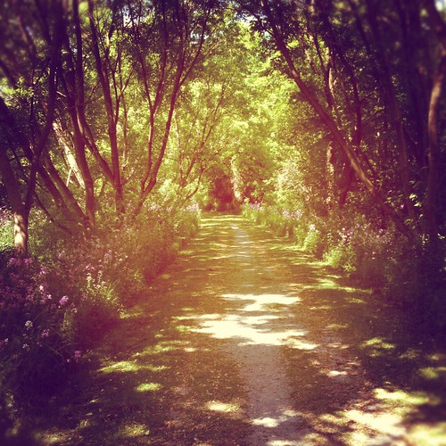
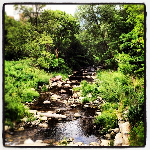
My husband dropped me off near Kipling and Steeles and I picked up the trail on what seemed to be a service road.  Although nearby apartment towers loomed over the tops of the trees I felt incredibly isolated and alone.   I walked deep in the dappled shadows of urban forest, the trees themselves only allowing the briefest glimpse of nearby towers.  It was green, all the greens of the natural world.  The greens I dream of, cool and dappled, as I sit for hours and hours in my grey cubicle in the sky.  The crisp gravel beneath my feet, the breeze through the trees and soft birdsong provided a gentle soundtrack to my lonely trek.  

Rowntree Mills Park
From the start, it seemed as though I drifted through a dream...

It was almost an hour before I saw another person.  Once I joined up with the main paths at Rowntree Mills Park, it was raucous children and dogwalkers all around.  I ran into a young woman and her beautiful dog in one of the parking lots there and she joined me for a while and chatted.  I was grateful for her company and she was very informative about the coyote and deer sightings in the area and some of the regular peoples and goings on in the park.  I think in all my time of walking in the trail I have never once come across someone so friendly.  Usually people might say hello or exchange smiles and a little back and forth about dogs or the weather.  It was enjoyable to have a little connection and conversation.  Because of safety considerations, I don’t usually listen to music when I am hiking.  I prefer to be aware of my surroundings.  So usually it is just my lonely inner dialogue and me.  

photo.JPG
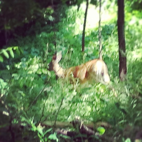
Gentle drifts of purple and white followed me, beckoned me, until I was dashed upon the harsh shores of highway and concrete...
My journey through Rowntree Mills Park is short and, with good and pleasant chatter to speed the time, I was in Blue Haven Park before I knew it.  About halfway through the park I was compelled for reasons unknown to look behind me and spied a deer.  Soft in shadow as if a dream.  We mutually froze on the spot and gave each other a good, long, silent stare, and then, suspecting I wasn’t much of a threat, it meandered up the path and into the trees.  I’ve seen deer a few times up this way now and then and it’s always a breathtaking sight. I was lost in a daze for a while after that.  


Deer Sighting in Toronto
I only remembered my camera when it was too late.

I gradually made my way to Summerlea Park.  It’s a big park and It took forever to walk.  I haven’t been able to determine the square acreage but I am certain that it is the same size or even bigger than High Park.


Hydro lines at Summerlea Park
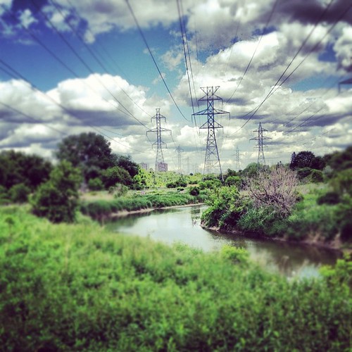
Hydro lines slice through the heart of Summerlea

Counting 20 minutes to rest, water up and eat it took roughly two and a half hours to traverse it from end to end.  As I passed a retention pond, I could hear hymns drifting over the water, haunting and atmospheric.  At first I thought it might be a TV or radio from a nearby apartment tower but it turned out to be a prayer meeting in a recreation building at the back of the park.  It was another long walk with hardly another soul in sight, but peaceful and beautiful.  One of my favourite go-to walks. 


Retention Pond, Summerlea Park
Despite the signs of human life all around, Summerlea is often vacant and unused.

Then it was through Pine Point Park, a short little thing that I have written on before.  At the south end of the park, one is forced under the 401 to continue on the trail.  Usually there is ample room to manoeuvre under there but the overpass is currently being repaired and foot and bicycle traffic is forced through a very narrow passageway.  Twice, in the short span of time that it takes to traverse it, I was almost bowled over by a cyclist going way over the speed limit (and there are extraa signs posted at both entrances even reminding cyclists to slow down).   He didn’t even have a bell or bothered to call out to let me know he was behind me.  I have encountered this fellow back here before. Most cyclists and pedestrians do their best to share the path, but he’s a bit of a bully.  First aggravation of the walk.


Under the 401 at Humber River Trail.JPG
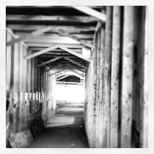
A tight squeeze under the 401.

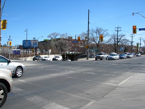
The second frustration came shortly after at the end of Crawford-Jones Park.  Here, the trail ends and to pick up the next portion of it you have to walk down Weston Road a short distance.  Normally this isn’t too bad, but for the next couple of years this corner is going to be under continued construction as Metrolinx work swings into full gear.  

Endless construction at Weston Road


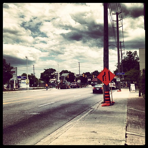
The noise after five hours of isolation was jarring.  The exhaust from cars and buses and the dust from all the construction work was choking.  The traffic was snarled and angry and impatient with the long waits.  My plan had been to walk along Weston and join up with the official entrance at Cruikshank Park but I quickly decided against that.  I headed down the stairs at St. Philips Road, not the safest of choices when walking alone, but a far more pleasant alternative that offered a very quick escape and meant not having to endure an attempt of crossing over St. Phillips Road. 

Stairs at St. Philips Road
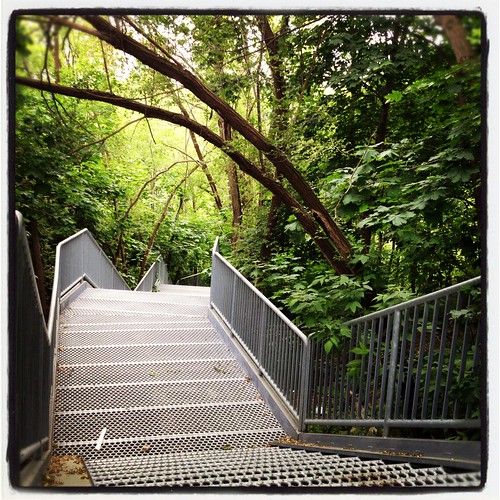
Back to green and life.
 The path underneath St. Philips is isolated, nothing more than a narrow dirt footpath.  The branches of the surrounding trees dip low onto the path and the grass grows tall on either side.  It is claustrophobic and eerie.  A dead dog or coyote spied in the grass only intensifies my uneasiness.  

Cruickshank Park
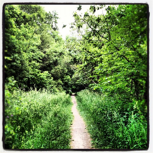
The type of sight one might expect in a horror film...  There be chainsaws and masked men here, I know it.

Another rest in Cruikshank Park made me suddenly aware of how out of shape I really had become after the winter and a prolonged illness.  My legs ached.  It was there I regretted not bringing another gallon of water (my dog is a little water obsessed), more dog food and a sweater for myself.  Ominous clouds had been rolling in over the course of the afternoon and the temperature dropped considerably, chilling my enthusiasm.  We lingered a little longer here than at our last break while my dog enjoyed a good stick.  This is a short chain of three linked parks but, by this time, I was also feeling a little discouraged as this portion of the trail runs east/west instead of north/south and, after having spent a good portion of the trail in Summerlea going the same direction, I really hadn’t felt like I made much progress during the previous four hours.  

Hurricane Hazel Victims Memorial, Raymore Park.JPG
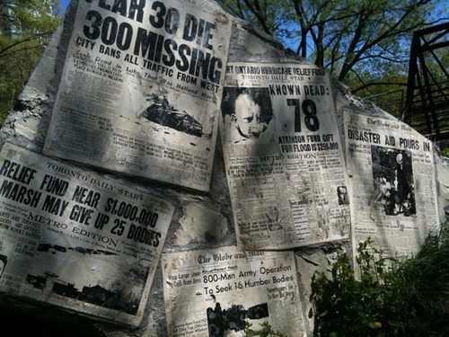
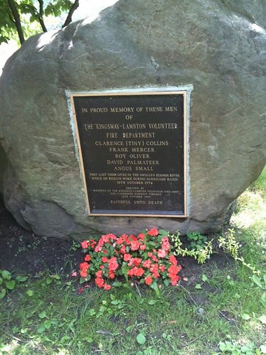
Hurricane Hazel Victims memorial at Raymore Park

Raymore Park turns north/south again and the short but steep climb at the South portion of it was a killer given the already five plus hours of walking I had endured. 


Raymore Park
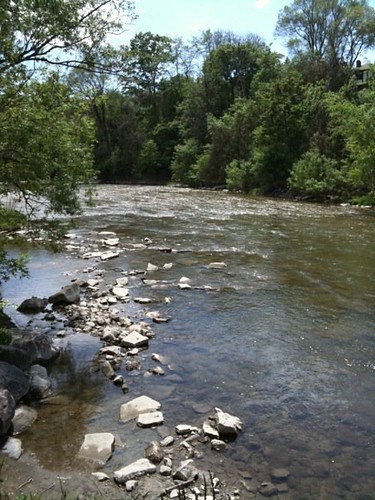
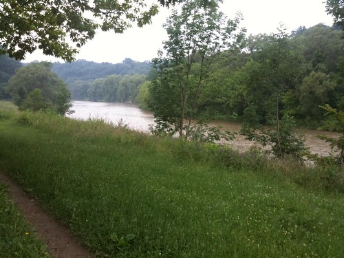
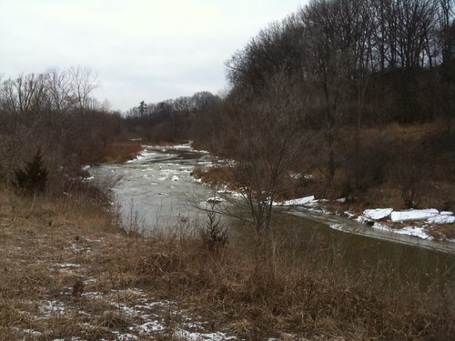
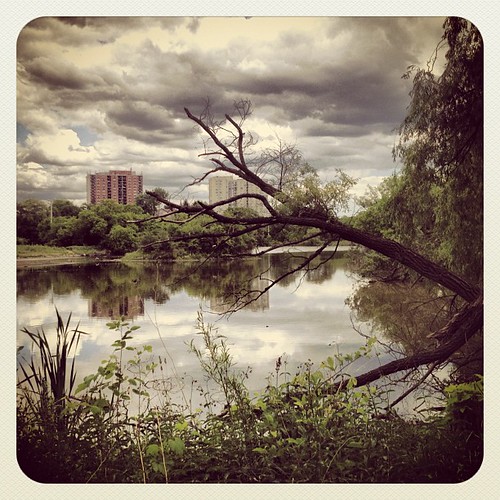
The river is strong here.

By the time we reached the Ukrainian Canadian Memorial Park I could tell that my poor dog had had it.  He was still very perky, but was definitely tiring out.  While waiting for the lights to change at Scarlett and Eglinton I gave my husband a call and asked him if he could pick up the dog at James Gardens.  This is another frustrating section of the trail which temporarily forces the user to deal with traffic, and by then it was rush hour.  I could walk the path further down to James Gardens but decided to get off and cut across Edenbridge Drive and wait at the main entrance to the park.  I drive across there all the time but didn’t realize the entrance to the park was so far from the eastern end of the road.  This is one of the most pedestrian unfriendly roads in the entire city.  Much of the road does not have a sidewalk.  The shoulders of the road are very narrow with deep ditches almost immediately next to them.  Despite the million dollar price tags of the homes along there, many lawns are unkempt and not conducive to walking.  Cars whiz by at speeds much higher than the posted limit.  I keep my dog very close and do my best to move as quickly as I can to my destination.  

It had been my intention to carry on without the dog and just TTC it home when I was done.  By the time I got to James Gardens, though, it was 5:30 p.m.  I began to think about some of the more isolated portions I had to walk through further down and the time it had already taken me to walk the distance so far and decided I didn’t want to do it completely alone.  Disappointed, I called it a day.  The trail isn’t going anywhere, and for the time being, neither am I.  It certainly wasn’t a waste of Time, it was an incredible gift of Time.  I am immensely grateful for the day of freedom I was given which I have not experienced since I had children.  It was recharging.  Even now, when I feel a little overwhelmed by the demands of my life, I seek refuge in those rippled greens, dreamy purples, the gauzy soft deer, the feel of a cool breeze on my face, and the fleeting glimpse of the person I had once been all those years ago, when Time was all I had.    

James Gardens
Journey's end.

Let’s save it for another day, hopefully another window will open up this year.  

The next day I kind of thought that when I put on my walking pants my dog would run hiding, but no, he was totally ready to get back at it, even if it was just around the block this time.  

There are a few comments to give a heads up to anyone who may want to attempt a longer walk through here.  Bring a buddy.  There are a considerable number of isolated stretches that are just not very popular, and it can be a very long time before you see anyone.  Meet up with the wrong person and it could quickly turn a pleasant outing upside down.  Coyotes are also frequently spotted in many sections of the trail.  Be aware and vigilant for them.  Be prepared for a serious lack of access to bathroom facilities and fresh water.  If there isn’t a facilities building located in a park, there will usually be a port-a-potty, but only in the summer months and they may be located at the main entrance of the park which may not handy or marked from the main trail or easy to miss.  Summerlea, in particular, stands out as you would have to leave the trail for a considerable distance before hitting the main entrance.  Peeing out in the open in Toronto parks is illegal but I’ve come across volumes of people seeking relief in the bushes on my various treks and it’s easy to understand why.  I was also nervous about tying my dog up if I did use one because I did not want people to think I was abandoning my dog and usually there is never anything handy to tie him up to even if I wanted to.  The port-a-potties are usually out in the wide open some distance a way from trees or fencing.  I have never used one either so I also can’t vouch for the condition or cleanliness.  I did not notice one working water fountain the entire trek.  If there was one visible from the path I stand corrected. If you’re going to do an extended walk on the trail, pack your own water and pack a lot.  There were also very long stretches without a garbage can, so be prepared to tote your garbage and dog waste bags. Again, at the time, Summerlea was by far the worst for lack of garbage cans (this situation has now been somewhat corrected).  There are many rules but not much assistance to ensure users don’t break them.  Things like this are never too much of a concern if you on a short walk but were issues for me on the longer trek.  

In the end it took me over seven hours to walk the stretch that I did.  Keep in mind that I am a very short person and my brisk gait is a slow crawl for most people.  I was also travelling with a canine companion, which meant frequent breaks to water, eat, rest, pee and poop-and-scoop. It totalled out to roughly 9.7 miles.  


Useful Information:

  • Duration of Walk:  Roughly four to seven hours (based on short legs, picture taking and doggy care)
  • Difficulty: EASY.  Relatively flat terrain throughout.  A few short steep hills, mostly paved, with some gravel and dirt paths.
  • Parking:  Lots of parking available at various park entrances. 
  • Washrooms:  Yes.  Facility buildings and Port-a-Potties only at park entrances. 
  • Local Coffee Haunts:  No.  Really not much of anything. Coffee dies North of Bloor Street.  
  • Safety Factor:     Medium-High.  Buddies are best.  Be watchful for coyotes  
  • Special Gear?:   A good pair sneakers, food and water.
  • Suitable for Dog Walking?:  Yes.  Dogs must be on leash.

Happy Trails!


Tuesday, April 26, 2011

Walking Tours

The rain is falling, the temperature is rising, the flowers are growing and Walking Tour season is upon us!  

Besides the more tourist oriented tours to be had around the city, there are a number of organizations in Toronto which offer guided walks highlighting history, culture and infrastructure.  Best of all they are free!  Sadly, I never get to go as they are usually held on the weekends and I have an odd work week that forces me to work on weekends  (I really work seven days a week doing various things, but four of them are as a cubicle jockey and I'm pretty much tied down when all the really fun stuff happens).  This year I think I can sneak in a couple of walks and am going to try my best to do so.  But I thought I would at least pass them along for your walking pleasure.  

Coming up in two weeks time, on May 7th & 8th are Jane's Walks.  These walks are inspired by and remember Jane Jacobs, who was an urban activist and a huge proponent of walkable cities.  She passed away in 2006.  There are a number of different guided tours, led by volunteers, which explore different communities and topics.  The first weekend was held in 2007 and since then the concept has gone global with Jane's Walks being held in cities around the world.  This year there are large number of walks on a variety of themes including pedestrian issues, labyrinths, immigration and history.  You don't need to register; just note the walks of interest to you and the times, show up and enjoy.  


Heritage Toronto offers walks throughout the seasonable months of the year, mostly on weekends.  These walks focus on history, architecture and nature, are free and do not require reservations.  I like that these are offered over the spring, summer and early fall.  Of further interest, there a several downloadable  self-guided walking tours available from their website, so even if you can't make an actual guided walk, you can still benefit from what they have to offer.  


Happy Trails!

Monday, April 25, 2011

[murmur] Toronto - The Junction

The Junction


I had decided to celebrate the first seriously warm day of the year by taking an extended  walk with my dog.  I have been looking for different ways to explore this City of mine and decided to try my feet on a [murmur] walk.  [murmur] is a series of self-guided audio/phone walks that explore the oral histories of a particular neighbourhood from those who have lived or had unique experiences within them.  I first noticed a [murmur] sign on a trek through Kensington Market last summer and not having a phone on me at the time to check it out, I visited their website when I got home at the end of the day.  [murmur] is set up in a few locations around Toronto and in a few other Canadian cities and international venues as well.  It’s completely free and all you need is a good pair of walking shoes and a cell phone.  A neighbourhood is chosen and throughout it, at random sites, signs in the form of green ears are posted inviting you to call, enter a pin number (listed on the sign) and hear an account about the specific location where you are standing.  There is more than one story with each location and you can choose to listen through all the stories.  On the website for each neighbourhood there is a map you can print off, if you choose, and you can also listen to the oral histories directly on the website.  You can choose to walk around and listen at each post or just listen randomly as you come across signs.  You are also provided an opportunity to provide your own reflections if you have lived or have otherwise been influenced by the areas featured in the tour. I can't think of a more unique way to gain some insight that you might not normally get by reading a historical plaque or browsing through some media source or local archive.  This reeks of awesome high school history assignment and I am hoping beyond hope that there are a least a few teachers taking advantage of this fantastic resource.  My curiosity on it had been peaked for some time and with the weather finally on my side, I decided to try it out.


Murmur Toronto

Eight Toronto neighbourhoods and the Reference Library are currently featured through [murmur].  I chose to try out The Junction.  I live very close to this neighbourhood and often drive through it.  Every time, I would think that there were some things I would like to get a closer look at, but it's always been pushed to the back of the priorities list.  Now that I have some food allergies, there are some bakeries and restaurants here that can cater to my new diet and provide me with an excuse to visit and hang out here.  It was time to get to learn this neat little place intimately.


Graffiti near Runnymede St. and Dundas St. West

I printed off the charming hand-drawn map and plotted out my route.  Red dots on the map indicated where I would find signs.  I chose to start at the corner of Runnymede Road and Dundas St. W., since that was closest to me.  The map showed that there was a sign right there, but I couldn't find it.  That wasn't a [murmur] issue though, rather it was an issue with my own observational skills.  By looking at the map and and having some sense of the distance I would have to cover based on frequent drive-throughs of the neighbourhood I figured it was going to take me some time to cover all the stops, and since I could listen to them on line, I figured I was going to be okay if I had to skip a few or couldn’t find any.  I headed straight for the next stop on my route.  


Last Supper Detail, Eastern Angel House Restaurant, Murmur Tour

I headed north along Runnymede and then turned right at Maria St. making my way eastward.  I spied the tell-tale little green “Ear” a little way up the street and made my way towards it.  I'm not going to give away too many details about the histories.  The folks at [murmur] have done a lot of hard work and fabulous job at putting this together, and I would encourage everyone to give it a try themselves or at least listen to them on the website.  Besides, a story is never properly told second hand.  I did get a very good taste of the charming anecdotes that were in store for me, many told by life-long residents of the neighbourhood.  A fun little tidbit here that I did pick up was the proper pronunciation of this street.  It's not Maria, as you would normally pronounce it when spying on the word, but Mariah.  I decided to listen to just one story at each stop and then continued on to Gilmour Ave., turning south and back to Dundas.

Malta Bake Shop

The Malta Bake Shop is the next stop on the tour.  This place is a little bit of a local institution, offering a delight called pastizzi that everyone seems to rave about.  I suspect that it's not gluten-free, otherwise I would have tried it and reported back on it.  The Junction embraces "Little Malta" within its boundaries.  There were a number of waves of Maltese immigrants into Canada from 1826 onwards and the majority of the Toronto newcomers settled here.  Upwards of 8,000 Maltese immigrants and their descendants lived within the Junction bounds by the 1980's, but as often happens when a community becomes more integrated with its new country and culture, most have moved on.  Traces of their impact and presence can still be found throughout the Junction.


Maltese Canadian Society of Toronto

Malta Village


I cross Dundas southwards along Gilmour Ave. and find the next stop at the corner.  It caused a little bit of pedestrian impoliteness as, while in the process of dialing the number, I was in the immediate way of someone trying to access the pedestrian light button to request a light change.  Oops.  A few minutes to listen and then head south along Gilmour to find the Malta Park.  This is when I figure out the [murmur] map is really only a rough aid and is not to be taken too literally.  The park is actually further east along Dundas than what is indicated on the map.

Malta Park, Murmur Tour

The tour takes one several blocks eastward along Dundas before there is another stop.  As you pass Clendenan Ave., you begin to see the signs of gentrification that have recently hit this neighbourhood.  Trendier shops, cafes, restaurants galore, new building and restoration are all making their mark on the neighbourhood, rapidly changing and renewing the urban landscape.  One can hope that it doesn't change too much though, there is a certain charm in the crumbling facades that adds a distinct character to this portion of the city.  

Detail, Murmur Tour

Two more stops relate experiences of a shop owner in the area and tell a brief history of the Avenue Hotel, now a Dominos Pizza.  I turn right at Pacific Ave. and continue further south.  

Convenience Store Art, Murmur Tour


Pacific Avenue is notable for an old racetrack, the Carlton Racecourse, that once existed in the area, which was home to the first Queen’s Plates.  A stop here gives a brief run down on the history of the track.  Now the two long sides of the track are short residential streets, sided with tract, duplex housing, as is much of the neighbourhood.


Details, Pacific Ave., Murmur Tour

The [murmur] map will direct you eastward on Annette St.  There is an indication that an “Ear” is to be found near the old Victoria Royce Presbyterian Church, which is now being converted into condos.  I did my best to locate it but could not find it.  Perhaps it was temporarily relocated because of the condo construction or perhaps it was just my little unobservant self.   The church is a beautiful building and I am glad that it is being converted as opposed to being torn down.  As you wander along the tour you find a large number of churches and temples reflecting a variety of religions and emphasizing the importance of faith among the members of the community.  


Detail, Murmur Tour

The next two signs were on the south side of Annette Street in roughly the same area.  I should have crossed the street at Pacific Avenue, where there were street lights, but instead attempted to cross at Medland Ave.  That was a risky venture as the traffic volume is surprisingly high, and it is a crossing that takes some careful timing and patience.  At Annette St. and Pacific Ave. lies a small Masonic Temple. I haven’t been able to gather a lot of information about it, but it would appear that this Temple is the home of the last pipe organ to be found in a Masonic Temple in Toronto.  Also here is the Annette St. public library.  This is the second oldest building in the Toronto Public Library system.  It’s a very lovely little building with lots of ornate detailing.  Continuing further east on Annette St. is featured a short history on Dr. Minerva Reid, founder of the Woman’s College Hospital.  

Corinthian Detail, Annette St. Library, Murmur Tour

At Keele, I turned north.  This stretch between Annette St. and Dundas is primarily service buildings.  A college, provincial building, postal distribution centre and firehall all line this small portion of the street.  The Mechanics Hall can also be found here.  It’s early days saw it as a meeting place and reading hall for African Canadian males, most of whom worked with the rail lines.  There was no mention of it at the [murmur] stop vignettes featured here.  This hall helped to raise funds and donate books for the Annette Street Library and a historical plaque outside the library commemorates their contribution.  Outside the firehall across the street can be found the first fire-alarm bell for the firehall.  Well-patinaed, the engraving on the bell is pretty much indecipherable.  Another stop at the corner gives a chance to look around.  Further evidence of  transformational regeneration here is spied in the shape of restorations and construction of residential towers.  I wonder at how this community will deal with the large, sudden influx of new residents.  

Mechanic's Hall, Murmur Tour

Close to this corner can be found a large Salvation Army building.  While no longer offering services from this building, it is still maintained as a church.  The Salvation Army has had a presence in this location since at least 1912, although this building is obviously much more modern.  

Keele St. and Dundas Ave. W., Murmur Tour

Its is a long stretch eastward to the next stop, which brings us to one of the most crazy intersections to be found in the city.  Here converges Dupont St., Dundas St. W., Annette St. and Old Weston Road.  The pedestrian crossing on the east side of the intersection is the easiest, although it requires a two stage crossing at the middle of the street with a narrow pedestrian island as there are two separate lights.  The west side is for the more adventurous and I am very surprised that it is even allowed.  Especially across Dupont, which is merging from a ramp and drivers have a very limited view until they hit the intersection.  There is only one [murmur] stop here on the north side of Dundas with vignettes concerning life around the rail industry.  Railroads define the Junction;  a rough triangle in shape, the Junction is bounded on all sides by rail lines and its very name belies how important the industry was to the the area.  

Intersection of Dupont, Dundas, Old Weston Road, Annette Street

It is a long walk back towards the west.  We want to find Hook Ave. and the map indicates that Hook will meet up with Dundas but that’s a little misleading.  You’ll actually want to look for Watkinson Ave, following it north for a short block until you reach Hook Ave.  Here is yet another quaint street of duplexes, but it is interesting because if most clearly reflects the gentrification of the area, with older duplexes lining the south and new ones on the north.  Every available bit of space is used here and houses back right up against the rail lines.  Trains still rumble through and whistles blow frequently, a constant reminder of the important industry that defines this community.  I was unable to get the code to work at the [murmur] stop here and the website does not yet have any stories posted, but I would still recommend walking through this quiet, cozy little section.  Continuing through past Indian Grove Road, I was uncertain at first if I would be able to do the next part of the tour from that direction.  New construction was blocking much of the road and I was uncertain if I would be able to navigate it.  I pushed through and no one bothered me or prevented my passage.  

Hook Ave., Murmur Tour

The tour then encourages you to turn south down Heintzman Ave.  A short stop plays a vignette about the Heintzman Piano Company which was formally located here.  I had no idea that these pianos were made here.  I take piano lessons and all of the uprights at my school are old Heintzmans that were probably all constructed on this street.  A couple of Heintzman family members provide reflections on their own family history, the factory and the community.  

Lost windows, Murmur Tour

I followed the tour north on Keele street, turning eastwards on Junction Road.  Here I had difficulty following the tour.  This is a more industrial area.  Even with my dog as companion, I wasn’t exactly feeling comfortable.  Despite the small, narrow streets, traffic was heavy.  None of the streets are clearly named so I had difficulty determining my next turn off.  Then I couldn’t find the next “Ear”.  I gave up and decided to continue on, since I could hear the reflections on the website anyway.   There is another stop that appears here on the printed map (and there are several others north of here on the website map which don’t appear in the print off) but I know that area well.  There are a number of big box hardware stores that I have to pass, including a busy intersection that services them and with my dog in tow, I really didn’t want to bother.  I was getting crunched for time as well as I had to head home to greet my children from the school bus.  I headed back south along Keele and then turned westward on Dundas.  

A quiet man, Sculptor's Studio, Murmur Tour

There are a number of stops along this stretch, highlighting various aspects of life in the Junction including some of its more colourful characters, street life, grocery stores and shopping and theatre.  There are a number of cool little shops around here and also Rue Morgue House of Horror, notable for its glossy publication of horror industry news, as well as organizing horror film nights, expos and one of the more popular Halloween parties in the city.  

Rue Morgue, Murmur Tour

Turning north on Clendenan Ave., I revisited Maria Street, this time to check out the Knesseth Isreal Synagogue, the oldest synagogue built in Ontario still in use for its original purpose.  Stately and quiet, it sits unassuming in its neighbourhood and gives an insight into the people who once lived here and shaped this community.  I turn south on St. Johns Place and back to Dundas. 

Knesseth Israel Synagogue

Returning to the start, I was able to locate the first [murmur] sign that I had missed when I started the tour.  All in all it was an enjoyable outing that not only took me through the more obvious core of the neighbourhood but also along some of the hidden secret treasures that are not so obvious but obscure and otherwise forgotten.  The tour reflects not as much the recorded history that can be found on the books but rather utilizes the quiet memory and living history of the individuals who call this unique place home.  The Junction was an incredibly friendly neighbourhood.  It was obvious to many what I was up to and many made a point to give me lots of room or move out of my way to look at the codes on the signs.  I received warm hellos, smiles and polite small talk; my pup was happily greeted.  It made for one of the most enjoyable afternoons I have had in a long time, and I will definitely be walking the Junction again.  I highly recommend a stroll through the city listening closely for any [murmurs] along the way.  

Centennial Mural, Murmur Tour


Useful Information:
  • Duration of Walk:  It took me about three hours to complete the walk and there was one section that I skipped.  There were several places where I had difficulty finding the signs and back-tracked a few times to locate them.  I am also very short so I factor that in my walk times as well.  Each story is short a couple of minutes long at the most, but I also only listened to one at each location. I took a large volume of pictures as well.  I honestly believe that it should take about two hours to complete this walk.  
  • Difficulty:  Moderately Easy.  There are a few steep hills and also one difficult intersection to negotiate. The section with the hill can be avoided and the intersection at Dundas and Dupont can be approached from the Northside, crossing at Keele and Dundas instead.  Otherwise this is fairly flat terrain.  It is a long walk so takes some endurance to complete. There are plenty of cafes and restaurants along Dundas if one needs to take a rest.  I cannot vouch for accessibility for individual establishments.  
  • Parking/Getting There:  There is Green P Parking available at the corner of Dundas and Runnymede and on Pacific Ave. and Keele St.  I would recommend parking on Pacific or Keele as the Runnymede location is a very small tight lot.  Lots of parking at the other two locations.  TTC route 40 runs through this area along Dundas Ave. W. and it can also be accessed from Runnymede subway station by taking the 71 or 79 north, from High Park station by taking route 30 north or from Keele subway station by taking routes 41 or 89 north.  
  • Washrooms:  There are plenty of cafes to stop in, but be polite and buy something. 
  • Local Coffee Haunts:  Lots of chains and independents.  Tea shops too.
  • Safety Factor:  Good.  There are tons of people about.   
  • Special Gear?:  A good pair of sneakers works.  Dress for the weather.  
  • Suitable for Dogwalking?:  Absolutely!


Thursday, April 21, 2011

In Other News - April 20, 2011

Hey, Mayor Ford, we need to do this too:

Step Forward Hamilton

Of course, it doesn't look promising that pedestrian concerns are taken seriously by the Ford administration...

Toronto Star - City Scrapping Pedestrian Committee among others

How Stuff Works on Urban Exploring

Urban Exploring

Europe makes plans to clean city air

2050

Remember Participaction?  It's back!  (Did it ever really go away or did we just lose interest)

Nordic Walking

Walk for a good cause

Oxfam Trail Walker

The Art of Taking a Stroll

Torontoist - Pedestrian Art

Wednesday, April 13, 2011

Pacing Hospital Floors


William Osler Health Centre

There were no big hikes this week.  No exploring neighbourhoods. Hardly any dog walks.  No lurking in coffee haunts to write. There was a lot of pacing of hospital floors.
  
Both my husband and I came down with colds late last week, severe enough to wipe us out.   When our daughter became ill over the weekend, we chalked it up to something she ate and tiredly tucked her between us.  I made a feeble attempt to clock in a few hours at work on Sunday before I got sent home.  My daughter was still ill, so my husband tucked her and I in together while he went out, sick, to grab some supplies and food basics to tide us over.  While he was gone, my daughter became dramatically ill, so I called him home and he ran her to the emergency room.  I waited up, struggling against medicated drowsiness, for them to come home.  At some point in time, I must have fallen asleep because my son woke me up, frantic for me to help him get off to school on time.  My husband wasn’t beside me.  My daughter wasn’t in her bed.  They had never made it back home.  

My husband called just as I was reaching for the phone to check for messages.  She was being admitted.  Her fever was really bad.  She was severely dehydrated.  I got my son on the school bus, grabbed a taxi and made my way over there.  

It didn’t really hit me how bad it was until I got there.  She was ashen.  Hot.  Cerulean eyes turned dark and leaden.  She was incapable of focusing on a point, on my face or my eyes.  She rambled and complained of being dizzy.  At the height of her fever she wouldn’t speak at all.  She was hooked up to an IV.  She looked so small and fragile.

No one should ever see their child that way. 

Most weeks I’ll log in more than my fair share of kilometres roaming around the city, this week they were logged in a hospital room, overlooking the very trail that she and I have spent hours strolling together, deep in mother/daughter confidences.  

It wasn’t that long ago when flus and stomach illnesses and other things that we now just casually shrug away would regularly kill people.  And it’s easy to see how someone, in just a few short days, can go from being healthy and vibrant and vital to seriously ill.  I’ve often taken these things for granted.  I’ve stuffed myself with over-the-counter meds and carried on with life.  But I have respect now for the need to just stop and let the body deal and heal.  And I have learned to appreciate every little moment because it can be taken from you in a heart beat.  

It’s not over yet.  She’s out of the hospital now and with us.  But this illness seems to have aggravated some ongoing health problems that we have been puzzling over for the last year.  In the weeks to come there will be more poking and prodding and doctors and specialists.  But I’m going to make sure that I take some time with her, just the two of us, and walk with her hand in hand.  And I will be thankful.  

Friday, April 8, 2011

Spring is Here!

It was glorious today.  Warm enough to leave behind the hats and mitts.  Warm enough to inspire the dogs to sniff about excitedly.  Warm enough for a small troupe of kindergardeners to head out to look for "signs of spring".  And then I came across them.  Vibrant bed of crocus.  Energizing and refreshing.  Purples and yellows shocking after the long white winter accented in browns.


First a howling blizzard woke us,
Then the rain came down to soak us,
And now before the eye can focus -
Crocus.  
Lilja Rogers


Tuesday, March 29, 2011

Strolling along the Humber


Humber
The Humber, as seen between Cruikshank and Lions Park, near the intersection
of Lawrence Ave. W and Weston Road, Etobicoke

[This is an intro to a series of walks that I will be posting in relation to the Humber River.  While I have have walked the whole of the river from the City boundaries to the Lake, I have yet to attempt an full, unbroken trek from the top of the city to the bottom, but have plans to do so in 2011. ]

Toronto has the unique distinction of having Canada’s only designated urban Canadian Heritage River flowing through it’s bounds, the Humber River.  This beautiful river gently dissects the city from top to bottom with a graceful, peaceful ribbon of green.  The river is one of two that divides the city, creating natural geographical boundaries that physically separate the city into distinct regions.  The other is The Don River Valley on the East side of the City.  I have yet to make my way to the Don yet, but I’m slowly moving eastward in my treks and hopefully I can start some trekking there this summer.


photo.JPG
Temporarily Tamed by Winter's Touch
What makes the Humber so culturally important and why should you care?  First and foremost it is beautiful.  It wends and twists and gently curves it’s way to Lake Ontario.  Old trees grace it’s shores.  A multitude of birds and animals, including deer, can be spied near it’s banks, bringing the wilderness straight the city.  It has carved deep ravines through the city creating an oasis of peace and silence.  You can be conscious that the city’s hustle and bustle might lay just beyond the crest of that hill but be so far removed from it that all cares and worries are forgotten.  At first glance, it seems slow and calm, but watch the water flow over many of the engineered spillways along its route and witness its mighty power.  At its end, it swells and slows and supports a serene marsh.

photo.JPG
 Summerlea Park, Winter 2011
It was first used as a trading and portage route for our First Nations peoples and the “Toronto Carrying Place Trail” follows it’s banks.  Earliest evidence of human settlement along this river points back in time to a possible 10,000 years of human impact on the river.  

photo.JPG
Late Fall 2010, Pine Point Park
There is debate as to whether Étienne Brûlé, on behalf of Samuel de Champlain, became the first European to explore and live along the banks of the river, establishing trade and diplomatic relations with the First Peoples here.  One park along the banks of the river is named after him, however many scholars now believe he may have actually located much further west.   

photo.JPG
Summer 2010, Magwood Park, Etobicoke
The Humber was vital to the early development of the city.  Fort Toronto was founded at it’s foot where it met Lake Ontario and was a temporary home of the first Lieutenant Governor Simcoe when he first arrived in the area.  Settlement continued to grow outwards from the Fort.  Over time the fast flowing waters powered numerous lumber and grist mills along its banks, providing the materials to build the city and strengthen its economy.  

photo.JPG

Kipling Heights Park [not 100% sure on that one - may have been further up river],
Winter 2011, Etobicoke
On the night of October 15, 1954, Hurricane Hazel struck the City with great force.  It is rare for a Hurricane to make its way this far in land, usually they dissipate in strength once they hit landfall, and indeed, while this storm had been downgraded to a tropical storm, it proved to be a powerful one.  Already, it had caused horrendous devastation in Haiti.  It tore through the Carolinas and, instead of losing power, then steamrolled its way northwest to Toronto.  Despite, what was for the time, very accurate weather forecasts, few people paid heed to the warnings.  Storms of this strength had never been experienced here and the naïveté of Torontonians created a lax atmosphere that was unprepared for what was to come.  The storm raged late into the evening.   The water table was already saturated from heavy rains experienced the week prior.  Streams, rivers and creeks were at their peak.  The stage was set for a disaster.  

Raymore

Memorial to Victims of Hurricane Hazel, Raymore Park, Etobicoke.  This memorial
incorporates 

the remains of a bridge swept away by flood waters. 
The rains of the evening proved too much and large flash floods raged through the City along the Humber River, Don River and Etobicoke Creek, taking residents by surprise.  Many houses were ripped from their foundations, bobbing their way along the rushing waters towards the lake; some residents spending a cold terrifying night on their roofs, waiting for rescue that could not come.  Efforts to aid victims were hampered by the strength of the currents and an inability to find boats of sufficient horsepower to navigate the waters.  Many of the rescuers quickly became stranded themselves or lost their lives to the raging currents.  Thousands were instantly rendered homeless.  Eight-one lives were lost that evening.  Bridges were washed out throughout the city, creating traffic snarls for months after.  Several highways and rail lines were washed away, including the 401, creating headaches to find alternate means to move goods across the country.  To this day, with an estimated cost of at least $1 billion of today’s currency, it remains the largest natural disaster ever recorded in Canada.

Humber Firemen
Memorial to firefighters lost in the chaos of October 15, 1954.
Their firetruck was swept away as they attempted a rescue.
Home Smith Park, Etobicoke
The Canadian military was called in to deal with relief efforts and clean up.  Relief agencies immediately went into action, raising millions of dollars of funds from all over the world.  Provincial and federal governments expropriated much of the property along these rivers and placed strong restrictions on further development.  National flood plain management and strategies were implemented nationwide to prevent similar disasters elsewhere.  The Toronto and Region Conservation Authority was created to help manage these areas.  These areas are now planned as flood zones, where water can be allowed to move freely through the City without major impact on nearby residents.  Spillways, dams, retention walls and other engineered features along the river help to restrain and minimize flooding and direct the water when needed.  Yet even with all that management, the River is one to be respected.  Flash floods still do occur especially during the Spring thaws or after heavy rains.  Its current is strong.  Along it’s banks lie memorials to victims, many children who have been caught within its grip.  

photo.JPG

I shamefully wish I could tell you exactly where this picture was taken, but 

I seriously need to work on my note-taking skills...  Winter, 2011
But out of that horrible devastation, Torontonians were given a special and unique gift.  Deep into the heart of the City, fingers of forestry and nature tangle their way seductively towards the Lake.  Deep forested ravines isolate portions of the rivers from the City creating sanctuaries of greenery and silence.  Long stretches of recreational zones have been created along its banks and are easily accessible to most within the City and provide opportunities for biking, hiking, jogging, rollerblading dog walking, boating and fishing.  Need a first date idea but not a lot of cash?  A stroll along the Humber’s many parks provides an idillic spot to picnic and walk hand in hand.  Bird enthusiast?  The Humber provides plenty of opportunity to spy your avian friends.  Avid cyclist looking for an opportunity to bike a long distance without City traffic?  The numerous bicycle paths along its banks negotiate steep hills and turns and it’s long distance is a good opportunity to work on your endurance.  Don’t have a car but want to experience nature?  This is close enough and is easily accessible all along it’s bank via the TTC.  A portion of the trail system is even accessible by subway via Old Mill station.  

Humber Geese
Magwood Park, Summer 2010
In the following weeks, I will continue on with more in depth segments of the parks to be found along it’s path, in chunks that will allow for 2-3 hour hikes.  Several Discovery Walks also line it’s shores and I will focus on them as well.  Hopefully, I can aspire you to get out and take a hike, and if you’ve never been here before, experience a portion of the City that is like no other.  

Humber Mural
A mural tribute to the Humber found at Loblaws near Dundas St. W. and Scarlett St.,
Etobicoke
Happy Trails!

Some links of interest: