Make Time to Walk

Everywhere is walking distance if you have the time. ~Steven Wright

I was born a walker. Growing up in a one car family that my father needed to get to work while living in the outskirts of town meant that if you wanted to do anything or go anywhere you relied on your feet. This was so ingrained that I did not bother get a drivers license until I was 25. When I moved to the city in my early adulthood, I relied on buses to transport me to work until a strike taught me that the hour and a half walk to and from was reasonable and pleasant, at least on the good weather days. For seven years, while living in the car-obsessed and sidewalk-phobic suburban USA, I slowly lost the habit, but I've been gaining it back, going on almost daily adventures of urban exploration.

It never ceases to amaze me how little many of my friends know of their own backyards, even when they have lived in the area all their lives. We have traded an adventurers' soul for the mundane, stress inducing car commute, even driving to the store a few blocks away. Reassessing my own life and stress, I came to the realization that I was a lot happier as a walker, in the fresh air, in nature, interacting with people, seeing the small little things that make city life or country living so pleasurable, and which often get missed in the car.

I'll share my favourite walks and memories in and around my current home of Toronto, as well as Halifax, Chicago and Paris. Take a stroll with me.

Tuesday, March 29, 2011

Strolling along the Humber


Humber
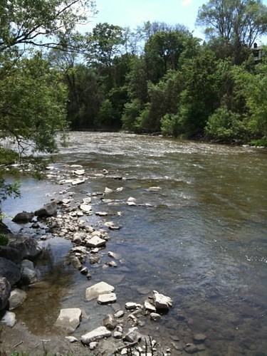
The Humber, as seen between Cruikshank and Lions Park, near the intersection
of Lawrence Ave. W and Weston Road, Etobicoke

[This is an intro to a series of walks that I will be posting in relation to the Humber River.  While I have have walked the whole of the river from the City boundaries to the Lake, I have yet to attempt an full, unbroken trek from the top of the city to the bottom, but have plans to do so in 2011. ]

Toronto has the unique distinction of having Canada’s only designated urban Canadian Heritage River flowing through it’s bounds, the Humber River.  This beautiful river gently dissects the city from top to bottom with a graceful, peaceful ribbon of green.  The river is one of two that divides the city, creating natural geographical boundaries that physically separate the city into distinct regions.  The other is The Don River Valley on the East side of the City.  I have yet to make my way to the Don yet, but I’m slowly moving eastward in my treks and hopefully I can start some trekking there this summer.
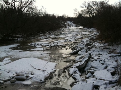

photo.JPG
Temporarily Tamed by Winter's Touch
What makes the Humber so culturally important and why should you care?  First and foremost it is beautiful.  It wends and twists and gently curves it’s way to Lake Ontario.  Old trees grace it’s shores.  A multitude of birds and animals, including deer, can be spied near it’s banks, bringing the wilderness straight the city.  It has carved deep ravines through the city creating an oasis of peace and silence.  You can be conscious that the city’s hustle and bustle might lay just beyond the crest of that hill but be so far removed from it that all cares and worries are forgotten.  At first glance, it seems slow and calm, but watch the water flow over many of the engineered spillways along its route and witness its mighty power.  At its end, it swells and slows and supports a serene marsh.
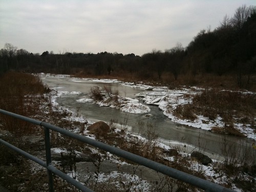
photo.JPG
 Summerlea Park, Winter 2011
It was first used as a trading and portage route for our First Nations peoples and the “Toronto Carrying Place Trail” follows it’s banks.  Earliest evidence of human settlement along this river points back in time to a possible 10,000 years of human impact on the river.  
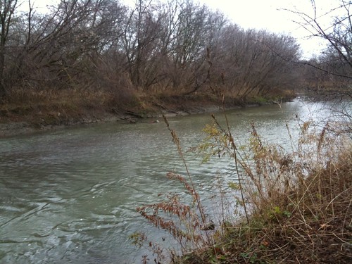
photo.JPG
Late Fall 2010, Pine Point Park
There is debate as to whether Étienne Brûlé, on behalf of Samuel de Champlain, became the first European to explore and live along the banks of the river, establishing trade and diplomatic relations with the First Peoples here.  One park along the banks of the river is named after him, however many scholars now believe he may have actually located much further west.   
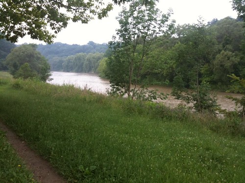
photo.JPG
Summer 2010, Magwood Park, Etobicoke
The Humber was vital to the early development of the city.  Fort Toronto was founded at it’s foot where it met Lake Ontario and was a temporary home of the first Lieutenant Governor Simcoe when he first arrived in the area.  Settlement continued to grow outwards from the Fort.  Over time the fast flowing waters powered numerous lumber and grist mills along its banks, providing the materials to build the city and strengthen its economy.  

photo.JPG

Kipling Heights Park [not 100% sure on that one - may have been further up river],
Winter 2011, Etobicoke
On the night of October 15, 1954, Hurricane Hazel struck the City with great force.  It is rare for a Hurricane to make its way this far in land, usually they dissipate in strength once they hit landfall, and indeed, while this storm had been downgraded to a tropical storm, it proved to be a powerful one.  Already, it had caused horrendous devastation in Haiti.  It tore through the Carolinas and, instead of losing power, then steamrolled its way northwest to Toronto.  Despite, what was for the time, very accurate weather forecasts, few people paid heed to the warnings.  Storms of this strength had never been experienced here and the naïveté of Torontonians created a lax atmosphere that was unprepared for what was to come.  The storm raged late into the evening.   The water table was already saturated from heavy rains experienced the week prior.  Streams, rivers and creeks were at their peak.  The stage was set for a disaster.  
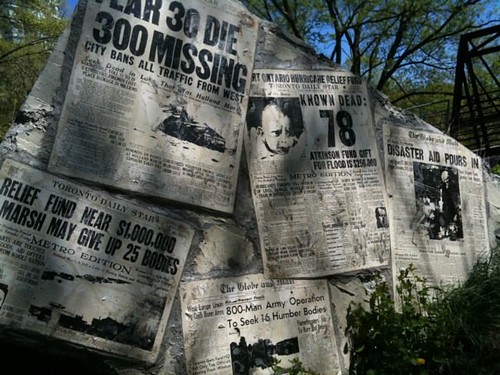
Raymore

Memorial to Victims of Hurricane Hazel, Raymore Park, Etobicoke.  This memorial
incorporates 

the remains of a bridge swept away by flood waters. 
The rains of the evening proved too much and large flash floods raged through the City along the Humber River, Don River and Etobicoke Creek, taking residents by surprise.  Many houses were ripped from their foundations, bobbing their way along the rushing waters towards the lake; some residents spending a cold terrifying night on their roofs, waiting for rescue that could not come.  Efforts to aid victims were hampered by the strength of the currents and an inability to find boats of sufficient horsepower to navigate the waters.  Many of the rescuers quickly became stranded themselves or lost their lives to the raging currents.  Thousands were instantly rendered homeless.  Eight-one lives were lost that evening.  Bridges were washed out throughout the city, creating traffic snarls for months after.  Several highways and rail lines were washed away, including the 401, creating headaches to find alternate means to move goods across the country.  To this day, with an estimated cost of at least $1 billion of today’s currency, it remains the largest natural disaster ever recorded in Canada.
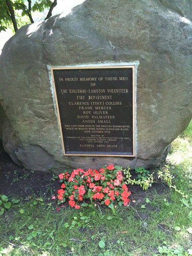
Humber Firemen
Memorial to firefighters lost in the chaos of October 15, 1954.
Their firetruck was swept away as they attempted a rescue.
Home Smith Park, Etobicoke
The Canadian military was called in to deal with relief efforts and clean up.  Relief agencies immediately went into action, raising millions of dollars of funds from all over the world.  Provincial and federal governments expropriated much of the property along these rivers and placed strong restrictions on further development.  National flood plain management and strategies were implemented nationwide to prevent similar disasters elsewhere.  The Toronto and Region Conservation Authority was created to help manage these areas.  These areas are now planned as flood zones, where water can be allowed to move freely through the City without major impact on nearby residents.  Spillways, dams, retention walls and other engineered features along the river help to restrain and minimize flooding and direct the water when needed.  Yet even with all that management, the River is one to be respected.  Flash floods still do occur especially during the Spring thaws or after heavy rains.  Its current is strong.  Along it’s banks lie memorials to victims, many children who have been caught within its grip.  
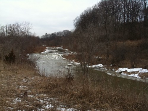
photo.JPG

I shamefully wish I could tell you exactly where this picture was taken, but 

I seriously need to work on my note-taking skills...  Winter, 2011
But out of that horrible devastation, Torontonians were given a special and unique gift.  Deep into the heart of the City, fingers of forestry and nature tangle their way seductively towards the Lake.  Deep forested ravines isolate portions of the rivers from the City creating sanctuaries of greenery and silence.  Long stretches of recreational zones have been created along its banks and are easily accessible to most within the City and provide opportunities for biking, hiking, jogging, rollerblading dog walking, boating and fishing.  Need a first date idea but not a lot of cash?  A stroll along the Humber’s many parks provides an idillic spot to picnic and walk hand in hand.  Bird enthusiast?  The Humber provides plenty of opportunity to spy your avian friends.  Avid cyclist looking for an opportunity to bike a long distance without City traffic?  The numerous bicycle paths along its banks negotiate steep hills and turns and it’s long distance is a good opportunity to work on your endurance.  Don’t have a car but want to experience nature?  This is close enough and is easily accessible all along it’s bank via the TTC.  A portion of the trail system is even accessible by subway via Old Mill station.  
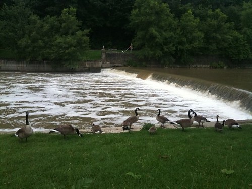
Humber Geese
Magwood Park, Summer 2010
In the following weeks, I will continue on with more in depth segments of the parks to be found along it’s path, in chunks that will allow for 2-3 hour hikes.  Several Discovery Walks also line it’s shores and I will focus on them as well.  Hopefully, I can aspire you to get out and take a hike, and if you’ve never been here before, experience a portion of the City that is like no other.  
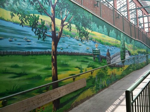
Humber Mural
A mural tribute to the Humber found at Loblaws near Dundas St. W. and Scarlett St.,
Etobicoke
Happy Trails!

Some links of interest:
Wednesday, March 23, 2011

The Breakup

photo.JPG

Dear Winter,

I really don't know any kinder, gentler way to break it to you so let me be blunt.  It's over.  I just can't see it working out anymore.  You have your thing and I have mine.  I have tried to live with who you are and what you do.  I have tried to love you just the way you are.  But I just can't do it anymore. Do you have to be so dark and gloomy?  Is it reasonable to delight in the one you love being curled in a corner, all SADD and blue?   In any relationship, there has to be a little bend, a little flexibility.  I have given myself over to you, thrown myself into your arms, dealt with your cold shoulders.  But like the good ship Enterprise, NC-1701, "I just canna take it anymore, Captain!".  You were all so seductive, soft and tempting at first and then once you had me, wham, you let it loose.  You have beaten me down with snow dumps and bitter cold, threatened me with massive icicles.  All the blankets, warm wooley socks and chocolate chili chai in the world have not sheltered me from your cold, bitter, icy heart. 

I made it clear we'd be "special friends" this year but I also made it clear that there would be an expiry date for our "friendship".  Spring has always meant more to my heart and I know she's coming, so you need to clear out before she moves in.  In case you didn't hear, the Spring Equinox was just a couple of days ago. And Wiarton Willie and Shubenacadie Sam both promised on your behalf that you'd be gone by now.  

I know what's going on, don't deny it.  Your little tantrum doesn't impress me much and it certainly isn't going to change the way I feel.  You have to accept the fact that we're through.  So go ahead, get it all out.  I'm patient, I can wait, but only for so long.  I'm sorry it had to be this way.  But I hope you know we'll always have January.  


Monday, March 21, 2011

Revelations


photo.JPG

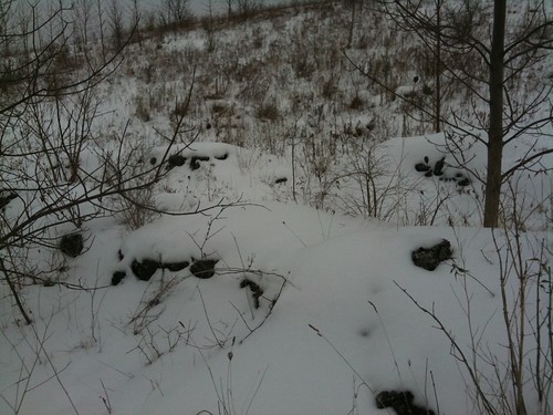
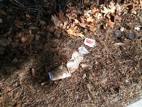
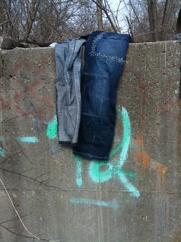
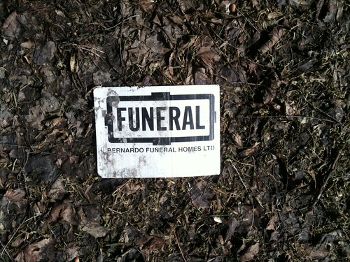
It’s always interesting in the late Winter and early Spring when the first snow melts are witnessed.  So much of our sins are hidden away by the snow and are revealed on masse with the first melts.  Many cultures revere this time as one of rebirth, but I look at it as a time of revelation.  Confessed in harsh brutal truth are the empty chip bags, lost receipts, cigarette cartons, paper mugs in Christmas designs, old notes, fast-food chain toys, mounds and mounds of dog pooh that had been kicked under the snow, old used condoms and discarded clothes.  It says a lot about who we are and our vices.  They can only be hidden for so long.  Sooner or later everything that is wrong about ourselves becomes revealed, often uncontrollably and we are forced to deal with it and clean up the mess.

photo.JPG

I have had my own spring thaw during the last few months.  The revelation of a lot of personal things that I had been in denial about but which I could no longer ignore.  I have been in the throes of some soul crushing heartbreak and self-pity which I dealt with by burying myself in my work, my children, bad TV and even worse books.   Running and running on my treadmill.  I should have been walking.  It’s not to say that I wasn’t entirely on my feet.  Of course I kept up the dog walking.  There was one night spent wandering my neighbourhood in my pyjamas in the wee hours of the morning.  But there has been very little enjoyment in my walks the past few months and a whole lot of stumbling about, a little lost, dazed and confused.  But it’s Spring and time to set things right, clean up my own little mess and walk on.  


photo.JPG

Wednesday, March 16, 2011

Maple and Mud


Sugarbush Maple Syrup Festival at Kortright
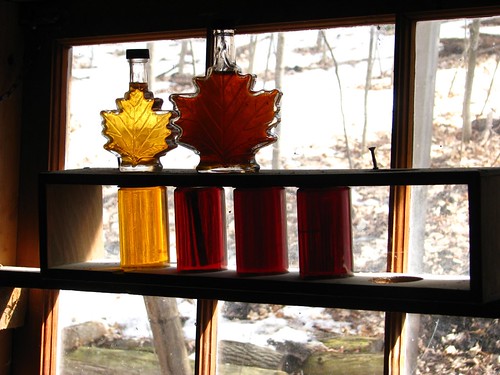
Different Grades of Maple Syrup
It’s March Break time and if you’re like me you have small children to amuse and you probably need to do it cheaply.  Last summer, I dragged my children over half of Toronto exploring many of the parks and ravines the City has to offer.  All for free or for a small fee.  I hate spending money.  And I want my children to have an appreciation for the world they physically live in, not the one they see on the small screen.  But just how many petting zoos and magic shows can you really do in a lifetime?  The Kortright Centre for Conservation is a great place to go.  It has a very low admission price and they have tons of programs all year long that are both educational and entertaining for children.

My husband decided to take the week off to spend with our kids.  He spends a lot of time working overseas and rarely has the opportunity to spend quality time with them.  I had noticed the last time that I had gone to the Kortright Centre with my son’s school field trip that they had a maple festival.  Perfect for my husband and his maple obsession and a great learning opportunity for the kids.  I could taste the family outing potential!  I mentioned to my husband last week that I suspected that it must be happening soon, if it hadn’t already happened.  He checked the site and sure enough, just in time for March Break, the festival was in full swing with a ton of activities for the kids.  I had been hankering for the winter to be over so that I could check out some of the trails with the dogs. And the weather was beautiful.  Everything was in perfect alignment for a lovely family excursion into nature.  We piled ourselves, the kids’ best friend and two dogs into the Momobile and headed north. 


Kortright Centre for Conservation

Of course, it seemed like half of Toronto felt that way too.  We left several hours later than we were planning.  It was almost lunchtime before we hit the road.  We got there in great time, but the cars were piled up at the entrance.  After over half an hour idling, the dogs were getting antsy and I got out to walk them around while my husband continued to the entrance.  By this point in time he was told that the park was “closed” because all of the parking spaces were gone, but they still let him in and he was able to find a spot.  

Kortright Centre for Conservation

We made our way to the visitor’s centre and picked a map and brochure.  Just outside the visitor centre, a huge line up awaited to board the wagon rides which were set up to take enthusiasts through a small loop near the entrance of the park.  We decided to forego that and went right for the maple tour.  

Kortright Centre for Conservation

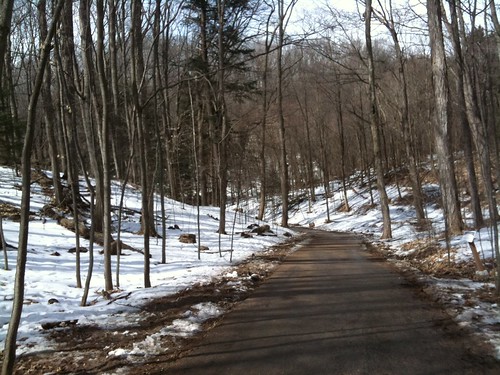
There are two types of tours you can take, a self-guided tour or a directed one.  We had a handy map so we decided to hike ourselves.  It seemed like a pretty easy loop and we had a couple of dogs with us and kids with low attention spans so we decided to head on ourselves.  It was the perfect day for a family outing.  It was a wonderful, balmy 11 degrees outside and really comfortable.  A word to the wise however.  Despite all the snow still on the ground, the spring thaw is underway and it’s pretty muddy and still very icy in places.  Wear waterproof boots with good grips.

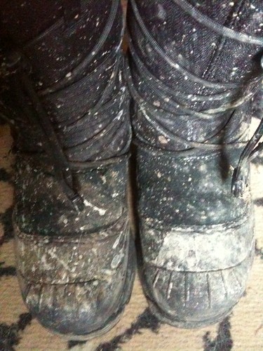
Muddy Boots
Mud was the secondary theme of the day.  Our boots were coated.
And don't get me started on the state of our dog's fur...


Kortright Centre for Conservation

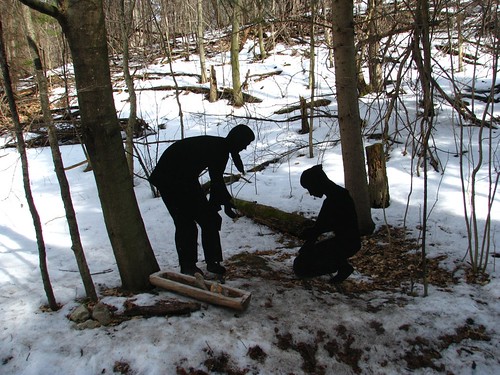
The path starts right behind the visitor centre.  There are tons of people hitting the festival so it’s pretty easy to just follow the crowds.  All along the walk, signs highlight interesting facts about maples and maple syrup and its production.  At the bottom of the first steep hill is a small display demonstrating how First Nation Peoples gathered maple sap, cutting a gash in a tree and using twigs to guide the sap into hollowed out log/troughs.  

Sugarbush Maple Syrup Festival at Kortright
Displaying First Nations methods to collect sap.
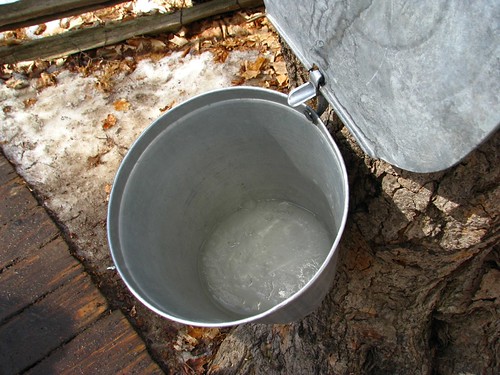
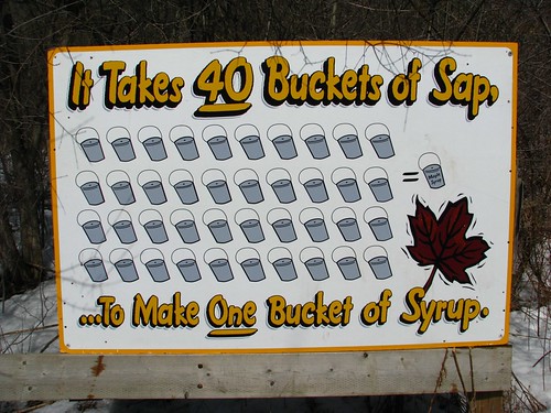
A short distance further and you spy trees with metal buckets attached.  You are free to go ahead and have a look inside.  My children were surprised by the contents.  “There’s water inside!”  No, that’s tree sap.  It was hard to make them understand that this would become maple syrup.

Sugarbush Maple Syrup Festival at Kortright
That's not water ... that's future pancake dressing.
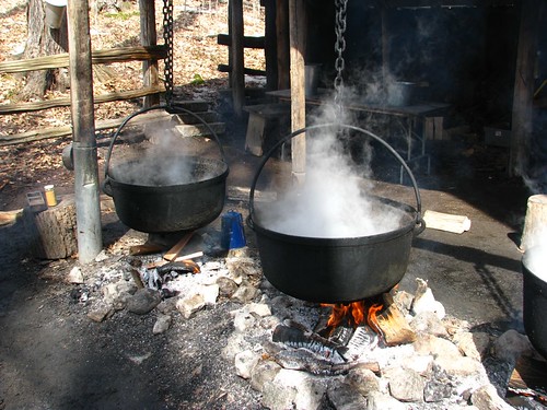
We walk further on and round a bend to come across some demonstrations of early maple syrup production.  Rough, crude buildings house shelter steaming kettles.  Firewood, at the ready to keep the fires roaring, are stacked to one side.  A small group of people, dressed in early settler type clothes, are hard at work making small batches of maple syrup.  Here you get the opportunity to taste both samples of sap and finished syrup.  The sap lives up to it’s appearance.  It is very watery and almost tasteless.  The syrup is fresh and fantastic and reminds me of the syrup of my youth.  The children stood for a long time watching the syrup boiling away in the kettles.  They seemed genuinely appreciative of the work involved in making one of their favorite breakfast staples.  

Sugarbush Maple Syrup Festival at Kortright
Maple syrup in production.
The path twists onwards and we find another shack, this one demonstrating more modern production of maple syrup.  Outside, lines of plastic tubing hang like garland from the trees, collecting precious sap and drawing it towards the shack.  Inside a demonstration on production and maple grades is being conducted and my husband and the girls decide to hang around to hear the talk.  My son and I continue onwards.  

Kortright Centre for Conservation

I let my son have the map and have some fun orienteering.  We rambled about for the better part of an hour while he tried to figure out where the entrance was for the path that he wanted to take.  We eventually gave up and I pointed him back to the Visitors Centre, intending to pick up the forest trail with him, but we ran into my husband and the girls there.  Everyone was a little tired and hungry and we figured it was time to go home.  But of course, we had to hit the little shop first and stock up on maple supplies!  Maple coated almonds, Maple suckers, Maple butter.  Maple, Maple, Maple.  You can never have too much Maple!

Sugarbush Maple Syrup Festival at Kortright


  • Duration of Walk:  The Kortright Centre pamphlet gives about 1 hour for the guided walk and this was about right.  It took us almost two, but we were rambling slowly and taking our time at the different demonstrations.  We also did a little bit of our own walking after the Maple Sugar Walk.  
  • Difficulty:  Moderately Challenging.  There are very steep hills that need to be negotiated.  Ice and mud make for slick walking surfaces.
  • Parking:  There is parking available, however plan to get there early as this is popular and the lots fill up fast.  There is an admission fee to get into the park, which can be obtained from their website linked above. 
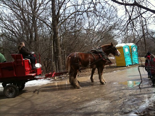
  • Washrooms:  There are washrooms in the Visitor Centre with lots of stalls.  I overheard someone mention port-a-potties, but did not see any.  (March 22, 2011:  To demonstrate how observant I am, if I had looked a little more closely at the pictures above, I would have clearly seen port-a-potties!)
  • Local Coffee Haunts:  There is a cafe in the Visitor Centre.
  • Safety Factor:  Good.  There are tons of people about.  Be careful and mindful of icy patches.  Keep a close eye on small children to ensure no one goes wandering off.  
  • Special Gear?:  A good pair of boots, waterproof, with grip.
  • Suitable for Dogwalking?:  Yes.  There were plenty of dogs enjoying the trail.  Since there are so many people, be polite and leave any overly excitable dogs at home.  Dogs must be on leash at all times in the Conservation Area. 

Tuesday, January 18, 2011

Urban Exploring - A Walk in the Winter Woods


photo.JPG

"Go to the winter woods: listen there, look, watch, and "the dead months" will give you a subtler secret than any you have yet found in the forest." - Fiona Macleod in Where the Forest Murmurs

Today's walk was the kind that a friend of mine has cleverly coined a "CSI Tour".  One of those treks that is so far off the beaten track that she feels I'm likely to either find a body or become a body.  I will admit to a certain foolhardiness but, as commonly pointed out, nothing ventured, nothing gained.  I happen to like knowing what's around every corner even it seems a little scary or dangerous.  Sometimes appearances can be deceiving.

I had to run our vehicle to the shop which was a considerable distance from the dog that I have to walk in the mornings, at least if I were to follow conventional sidewalks.  It was my thought to cut through Crawford-Jones Park and then Pine Point Park and make my way to Islington Avenue from there.  The weather had called for rain.  I usually don't pay too much heed to forecasts other than preparing myself for the worst, the weather is what it is and does what it does and there is very little I can do about it.  However, I was blessed with the rain holding off.  The air was sodden and the sky dim.  It was surprisingly warm and comfortable and I didn't feel the need to dig out my mitts or hat the whole day.


I was a little unsure about the best way to approach the park from Weston Road.  Should I access it from Cardell Avenue or Dee Avenue?  I ended up choosing Cardell, but I could have taken either, both dead end to the park.  The path was not cleared and would have been hard to find if it had not been for the numerous footprints of more experienced visitors of the park.  I had every intention of walking straight to Islington Avenue, running some errands at a nearby shopping complex and then walking over to pick up my pal for his morning exercise, but the explorer bug took over and it was time to get lost in the woods.   I had some time to kill and I knew that geographically I was penned in by the 401, housing, a golf course and train tracks.  Eventually I would find civilization again.  


photo.JPG


If you will remember, in a previous entry on Pine Point Park, I had made mention of a small footpath that I had noticed near the pedestrian bridge crossing the Humber River. It had been my assumption that it made it's way towards Islington somehow.  So I was surprised to discover that it actually curves around and makes its way along the South-western bank of the River.  


photo.JPG


The path makes its way east a fair distance.  It is obviously well used by both man and beast.  It's hard to tell if it is paved underneath the snow, but I remember that in the fall when I first checked it out, the entrance at least was basically a dirt foot path.  


photo.JPG

The constant drone of the highway traffic never dissipates.  Perhaps it is the lack of foliage or the cold, still air, but it is loud and an ever present reminder that I am really still in the city.


photo.JPG

The foot tracks peter out considerably at a small, narrow creek, slushily frozen.  A steep hill rises to the south beyond it.  I see some footprints and dog tracks beyond and continue on.

photo.JPG

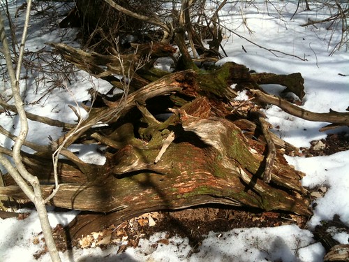
The hill is steep and the snow is deep.  We trod carefully on, my dog and I, unsure of what lays beneath. An old rotting tree, with lots of hollows, reeks of skunk.  Perhaps a den.  Despite my best effort to keep him away, my dog excitedly nosed and sniffed about at the very limits of his leash while I feared a long, smelly walk home.  Thankfully, nothing stirred and I was able to convince my pal to walk on.

photo.JPG
Thar be skunks here!

photo.JPG
A happy dog is an exploring dog.
The trees grow so tall here, thin, stretching upwards to the sky.  It is so rare to see truly tall trees in the City.  Most urban trees are so stunted compared to their forest cousins.


photo.JPG

The tracks that I have been following begin to zigzag through the woods, weaving amongst fallen trees.  Despite seeing many animal tracks, I see not one creature, not even a squirrel.  Even the birds are no where to be found.  The air is still and, despite the omnipresent sound of highway traffic, hushed.


photo.JPG

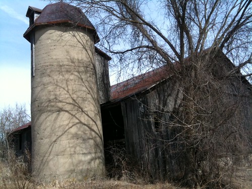
Cresting the hill, we come across a strange formation.  It's hard to tell if it's natural or man-made.  Large, cylindrical and pock-marked like old, worn concrete.  Its presence is jarring.  

photo.JPG

Suddenly, we are at the summit of the hill. It is large and flat and treeless.  Tall grasses and other plants tower over the snow.  In the distance I can see familiar highrises.

photo.JPG

The footprints that I have been following distinctly end in the middle of the clearing.  Should I turn back?  I've already walked so far, but perhaps there is a reason no one has gone further.  I decide to push onwards, I can always turn back at any point.  I am more curious to see around the bend.  I see mounds of snow and what looks like trees lining a path or road.  It soon becomes clear that the trees are actually at the crests of hills lining a railway track.  As I get closer, I see evidence of what was perhaps a road or paved path once ran near here.  Jagged crusts of asphalt jut out from snow covered piles.

photo.JPG

I find myself working my way downhill, forced onto a slender ridge.  There is evidence that a deer ran through here.  To my left, a GoTrain rushes by.  To my right, old, snow-covered train tracks lie abandoned.  Despite all the signs of the city that surrounds me, I feel as if I am in the loneliest place in all of Toronto.

photo.JPG

Ahead I can see the ridge narrowing.  The sides are steep.  I will have no choice but to make my way down or go back.  I know better than to try to walk on the train tracks, best to take the abandoned route.

photo.JPG

We need to be very cautious.  The old ties are uneven and I come close to tripping several times.  As we walk along, a fence arises to our right, topped in barb wire, with signs urging us to to "STOP!" and warning of demolition activity within its bounds.  All seems quiet today.

photo.JPG


Ahead I can see Islington, but begin to fret.  I am blocked on my right by the train tracks and the fencing from my current perspective seems to run right up to the street.  I have driven by here many times, but I can't remember how close the fencing actually runs to Islington.  The tracks run under a bridge and I feel nervous about attempting to cross them.  Trains run fast and quiet sometimes, they can be on you before you know it.  Plus the climb on the other side is very steep, I don't want to risk falling.  But my goal is so close, to double back at this point would be disappointing.  I keep moving on, and am grateful to discover a small street ahead, preventing the fencing from marching up to Islington.  I have a point of egress!  Tired, I am able to cross it and make my way on to Islington.  I still have a long walk ahead.


Useful Information:


  • Duration of Walk:  Relatively short walk, but snow makes for difficult terrain in places.  Roughly two hours (based on short legs, picture taking, doggy care and just plain figuring out where the hell I should go)
  • Difficulty:  INTERMEDIATE to ADVANCED.  Involved walking in deep snow, trekking off beaten path, unpaved trails, no trails, climbing over obstacles, obstacles hidden in snow, steep climbs and descents and a sense of direction.  This is not accessible for those with mobility issues.
  • Parking/Getting There:   For Crawford-Jones Park, parking is available off Dee Ave.   You can access via Pine Point Park by TTC by taking Islington Route 37North and getting off at Allenby St. and walking east several blocks until it dead ends in the park.   Pick up the trail south, going under the 401.  You can pick up the trek from there.  
  • Washrooms:  No.  I will note that there was a Port-a-Potty this past summer located by the parking for Pine Point Park, however I cannot vouch whether it was available for public use. 
  • Local Coffee Haunts:  No.  
  • Safety Factor:  RISKY in some places.  Proceed with caution and at your own risk.  Take a buddy.  
  • Special Equipment:  Hiking boots - water-proof and suitable for deep snow.  Warm clothes.  Water and food.  A phone in case you get into trouble.  
  • Suitable for Dogwalking?:  Yes.


Wednesday, January 12, 2011

This Ain't No Skatin' Blog! Colonel Samuel Smith Park, Etobicoke

Skates unloved
Skates unloved...

I’m about to admit a deep dark secret, one so profound that it will likely cause mysterious men in sunglasses, black hockey jerseys and toques to enter my house in the dark of night, confiscate my passport, my VHS collection of CBC shows and bottles of maple syrup before whisking me off blindfolded to an undisclosed location deep below the 49th parallel.  

I can’t skate.

There, I feel better now that it’s out.  The number of times that I have donned ice skates can probably be counted on one hand.  And each of those occasions involved more time spent on my ass than on my feet.  For a short time before I took the plunge into motherhood, and therefore sensibility, I did inline skate,  but they always felt better and sturdier.  The wheels are pretty thick and it always felt I had a solid base to work with.  I was never any good at it and again had my fair share of embarrassing on-my-ass time, but I could awkwardly propel myself around parks for some exercise and that was all that mattered.  Ice skates I can’t seem to master.  Tottering on those thin little blades, ankles going here there and everywhere, gliding on sharp knives while everyone else is gliding by on sharp knives.  It’s cold, your toes ache, the skates are as hard and uncomfortable as hell.  I have a lot of respect for people who do it for a living because I have never had anything but a miserable experience on them.  

Thank goodness that this is not a skating blog because then were would we be?  With very few entries, that’s for sure!  This is a hiking blog!  But all the hoopla about the new skating trail at Colonel Samuel Smith Park has gotten me thinking about it and so with that I’ll take a few moments of your time to rave about the park. 


IMG_1564


I used to live a few blocks away from the park, when my children were still small enough to be carted about in strollers and wagons, and we spent lots of time there enjoying nature and fresh air and the water.  I had all but forgotten about it after we moved until I was lamenting the lack of choices to exercise my dog and a friend pointed out that there was a new dog park there.  Always looking for new experiences for both myself and my dog, I took the time to drive down several times in October to check it out.  Chatting with another dog owner, he mentioned that the City was building an ice rink there, but he wasn’t sure where.  My friend and I kept our eyes open for it while we roamed but never saw heads or tails of an ice rink, but now I understand the confusion.  This the first ice trail in Toronto and I can’t think of a better place than here.  It’s nice to see the City developing new ways to get people using their parks all year long.  I can’t tell you how many great parks that I have explored over the past year that have been relatively empty but popular parks like High Park remain crowded all day long, seven days a week.  Anything that gets people out, exploring their City and putting to good use everything it has to offer is a good thing.  And the buzz generating around the ice trail will hopefully also get people excited about what is in general a buzz worthy park.

IMG_1565
Wetlands
That’s not to say that there hasn’t been controversy over the development of the ice trail.  There have been concerns about the impact it will have on the local environment and the species which make it their home.  Compromises were made and the final design was in the end considered tolerable.  I always have very mixed, stomach tightening feelings about such matters.  I like to think of myself as a fairly green person and love nature.  But when you live in the City, surrounded by concrete and smog and traffic and noise, it becomes very easy to forget about the natural world.  We have removed ourselves too much from that natural world and these parks can go a long way to bringing us back.  Finding an appropriate balance between our needs and those of the world around us is difficult and not to be taken lightly and we certainly need to take steps both individually and as a whole to keep our impact minimal.  But if it takes a skating rink, which is located close the to the entrance of the park, to get people, especially children, outdoors and into the real world, then let’s do it.  

Colonel Samuel Smith was a Lieutenant-Governor of Upper Canada in the early 1800’s.  Born in New York, a loyalist and veteran of the American Revolutionary war, after the war he continued his service under the crown, spending time in England and in New Brunswick  and finally being stationed in the Niagara Region.  Upon his retirement he purchased a 1,000 acre tract (comprising the area between Kipling Avenue and Royal York Road, Bloor Street and Lake Ontario) in Etobicoke and became one of the first settlers in that region. 

The grounds where Colonel Sam Smith Park are located were formerly part of grounds of the Lakeshore Psychiatric Hospital, an important part of our City's collective history.  Opened in 1889, this hospital complex ran for almost 100 years until it’s closure in 1979.  Despite its use in some movie and television productions, it fell into disrepair for a number of years.  Much of the complex is now used by Humber College, Lakeshore Campus.


IMG_1566
A reminder that we're still in the City - A view of downtown Toronto
This particular area of Etobicoke is vibrant and active and one of my favourite areas in all of Toronto.  There are lots of independent shops and small, good restaurants and lively pedestrian activity.  Out of the three waterfront parks in this area, this has always been the one that I have noticed to be most used, at least during the weekdays. There is also great access to the park as the Kipling South bus goes right into it.  Numerous species of birds, turtles and beavers can be found here and there are plenty of new, helpful interpretive signs that provide a little bit of insight on much of the local wildlife and environment.  A small wetlands area has been created, which is one my favourite features of the park, it is very picturesque.  Another feature that I love is that it is right on the lake.  Except on the hottest, most still days, there is always a little bit of a breeze and, just like nearby East/West Humber Parks, there is a really great view of the downtown core on clear days.  There are plenty of trees throughout and it is really pretty to visit in the fall.  Trails take you right out to the peninsula and it's great vistas of Lake Ontario.  The trails are part of the Waterfront Trail system which is an ongoing effort to have an extended trail system along the Lakes and St. Lawrence. 

IMG_1567
Trees were getting bare

On my last visit there, I went with a friend.  We hit the new dog park first and gave our dogs a good run and then hit the trail.  It was a gorgeous sunny day, although a little on the brisk side, with a good wind.  There were plenty of people out and about except on the long stretch along the peninsula, fellow dog walkers, students and a lone jogger.  This isn’t a massively large park, you could do the whole thing in a leisurely stroll in less than an hour.  But there are all sorts of different environments to check out, from wetlands, to shrubby, rocky waterfront.  Trails are mixed with mostly light gravel surfaces and some paved paths.  If you want to extend your walk, stroll west through my old haunting grounds on Lake Promenade about 20 minutes to Marie Curtis Park, another charming waterfront park with a forested trail following Etobicoke Creek.  The neighbourhood in this area is an interesting mix of old cottage/bungalow style homes and newer, more upscale development and is a great walk.  This is a great park for families with a small playground nearby and lots of learning opportunities around every corner.  


IMG_1570
New dog run.
Useful Information: 

  • Duration of Walk:  Roughly one hour (based on short legs, picture taking and doggy care)
  • Difficulty:  EASY.  Relatively flat terrain.  
  • Parking/Getting There:  TTC:  (Subway) Get off at Kipling Station on the Bloor line.  Take the 44 Kipling South straight into the park.  It is the last stop on the bus run. (Streetcar) The 501 Queen Route heading rest stops right at Lake Shore and Kipling and the park is just a short walk down Colonel Samuel Smith Park Dr.   Parking:  There is paid Green P parking available in the park.
  • Washrooms:  There is a bathroom at Williams Coffee Shop.  Only available on weekdays.
  • Local Coffee Haunts: There is a Williams Fresh Cafe on the Humber Campus.  Strangely, it is not open on weekends. 
  • Safety Factor:  SAFE.  There were generally lots of people around, good for daytime treks.  As always though, you should be mindful of your environment and the people around you.  
  • Special Equipment: No.  Sneakers should be fine.
  • Suitable for Dogwalking?:  YES.  But please keep your dog on a leash.  There are sensitive habitats and dogs can be very disruptive.  

Links of interest:

Colonel Samuel Smith Park


Waterfront Trails

Guided bird walks:

Citizens Concerned about the Future of the Etobicoke Waterfront

Star Article (with video) on the new ice trail:

http://www.thestar.com/news/article/917950--ice-trail-is-like-a-walk-in-the-park-on-skates


View Larger Map